You are here: Home > Network List > TA - USArray Transportable Network (new EarthScope stations) Stations List
> Station I23K Minto, Yukon-Koyukuk, AK, USA > Earthquake Result Viewer
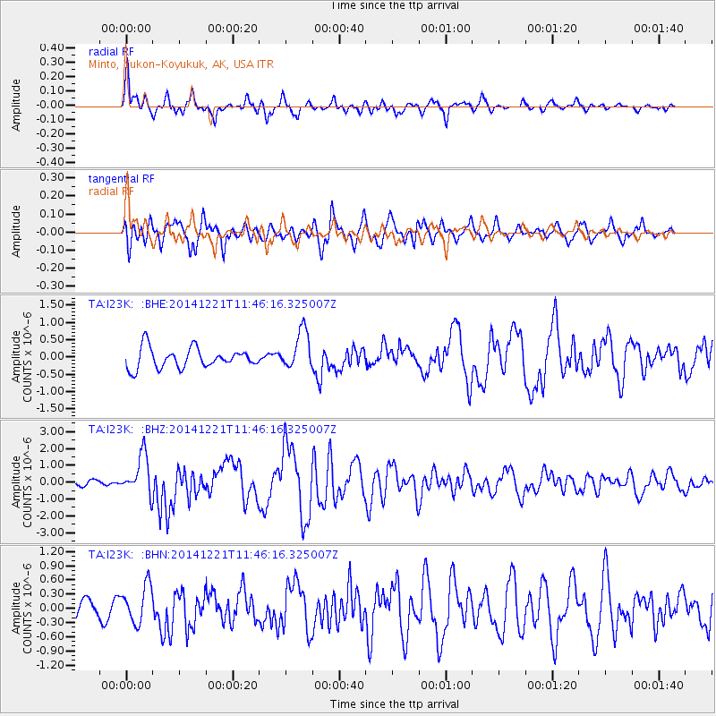
I23K Minto, Yukon-Koyukuk, AK, USA - Earthquake Result Viewer
*The percent match for this event was below the threshold and hence no stack was calculated.
| Earthquake location: |
Northern Molucca Sea |
| Earthquake latitude/longitude: |
2.1/126.7 |
| Earthquake time(UTC): |
2014/12/21 (355) 11:34:13 GMT |
| Earthquake Depth: |
41 km |
| Earthquake Magnitude: |
6.3 MWW, 6.3 MWB, 6.4 MWC, 6.6 MI |
| Earthquake Catalog/Contributor: |
NEIC PDE/NEIC COMCAT |
|
| Network: |
TA USArray Transportable Network (new EarthScope stations) |
| Station: |
I23K Minto, Yukon-Koyukuk, AK, USA |
| Lat/Lon: |
65.15 N/149.36 W |
| Elevation: |
149 m |
|
| Distance: |
85.6 deg |
| Az: |
24.932 deg |
| Baz: |
265.437 deg |
| Ray Param: |
$rayparam |
*The percent match for this event was below the threshold and hence was not used in the summary stack. |
|
| Radial Match: |
75.80017 % |
| Radial Bump: |
373 |
| Transverse Match: |
72.57395 % |
| Transverse Bump: |
400 |
| SOD ConfigId: |
827010 |
| Insert Time: |
2015-01-04 12:03:43.883 +0000 |
| GWidth: |
2.5 |
| Max Bumps: |
400 |
| Tol: |
0.001 |
|
Signal To Noise
| Channel | StoN | STA | LTA |
| TA:I23K: :BHZ:20141221T11:46:16.325007Z | 4.538247 | 1.2051347E-6 | 2.655507E-7 |
| TA:I23K: :BHN:20141221T11:46:16.325007Z | 1.0896637 | 3.963635E-7 | 3.6374843E-7 |
| TA:I23K: :BHE:20141221T11:46:16.325007Z | 2.001334 | 5.769086E-7 | 2.8826204E-7 |
| Arrivals |
| Ps | |
| PpPs | |
| PsPs/PpSs | |


