You are here: Home > Network List > AV - Alaska Volcano Observatory Stations List
> Station MAPS Pakushin Southeast, Makushin Volcano, Alaska > Earthquake Result Viewer
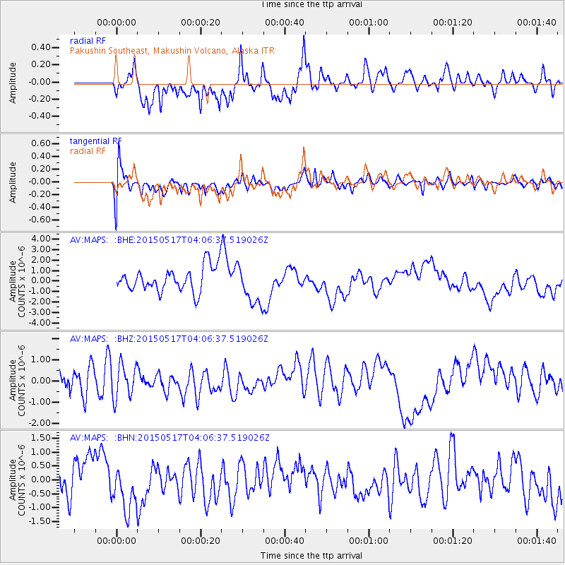
MAPS Pakushin Southeast, Makushin Volcano, Alaska - Earthquake Result Viewer
*The percent match for this event was below the threshold and hence no stack was calculated.
| Earthquake location: |
New Britain Region, P.N.G. |
| Earthquake latitude/longitude: |
-4.3/152.2 |
| Earthquake time(UTC): |
2015/05/17 (137) 03:56:17 GMT |
| Earthquake Depth: |
35 km |
| Earthquake Magnitude: |
4.9 mb, 4.8 mb, 3.8 MS |
| Earthquake Catalog/Contributor: |
ISC/ISC |
|
| Network: |
AV Alaska Volcano Observatory |
| Station: |
MAPS Pakushin Southeast, Makushin Volcano, Alaska |
| Lat/Lon: |
53.81 N/166.94 W |
| Elevation: |
333 m |
|
| Distance: |
67.2 deg |
| Az: |
24.875 deg |
| Baz: |
225.011 deg |
| Ray Param: |
$rayparam |
*The percent match for this event was below the threshold and hence was not used in the summary stack. |
|
| Radial Match: |
39.180416 % |
| Radial Bump: |
400 |
| Transverse Match: |
53.105293 % |
| Transverse Bump: |
400 |
| SOD ConfigId: |
7422571 |
| Insert Time: |
2019-04-18 22:19:03.590 +0000 |
| GWidth: |
2.5 |
| Max Bumps: |
400 |
| Tol: |
0.001 |
|
Signal To Noise
| Channel | StoN | STA | LTA |
| AV:MAPS: :BHZ:20150517T04:06:37.519026Z | 1.435548 | 8.078119E-7 | 5.6272023E-7 |
| AV:MAPS: :BHN:20150517T04:06:37.519026Z | 1.7623515 | 9.698655E-7 | 5.5032467E-7 |
| AV:MAPS: :BHE:20150517T04:06:37.519026Z | 1.675647 | 1.9872027E-6 | 1.1859315E-6 |
| Arrivals |
| Ps | |
| PpPs | |
| PsPs/PpSs | |


