You are here: Home > Network List > TA - USArray Transportable Network (new EarthScope stations) Stations List
> Station 833A Chaparral WMA, Artesia Wells, TX, USA > Earthquake Result Viewer
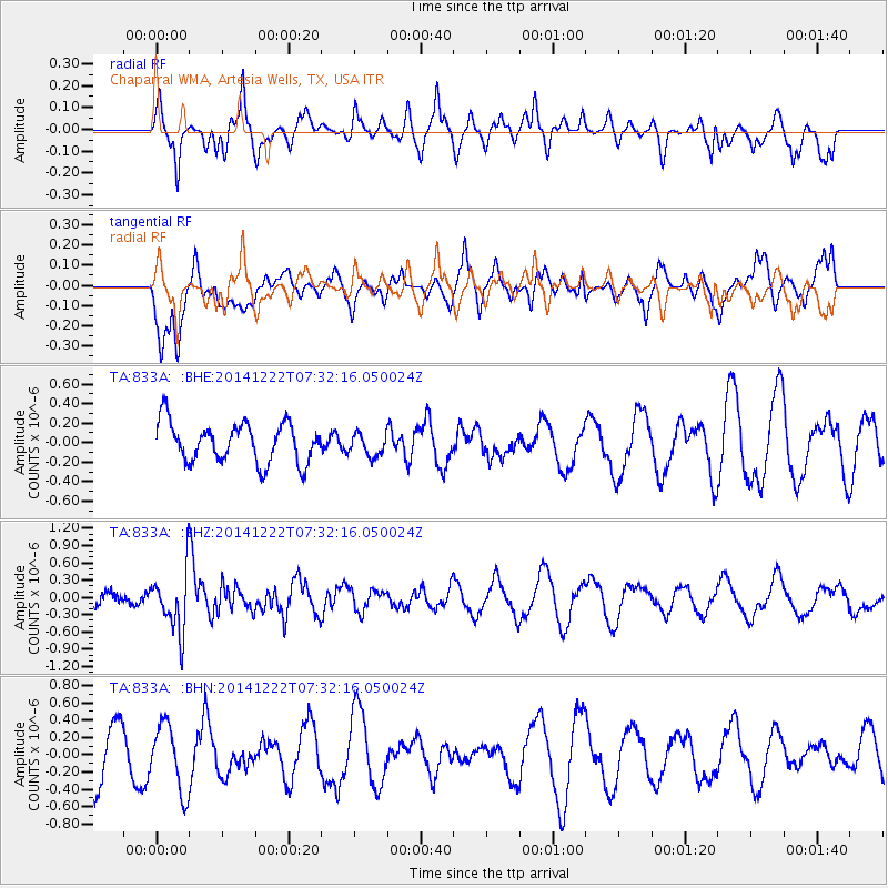
833A Chaparral WMA, Artesia Wells, TX, USA - Earthquake Result Viewer
*The percent match for this event was below the threshold and hence no stack was calculated.
| Earthquake location: |
Pacific-Antarctic Ridge |
| Earthquake latitude/longitude: |
-54.2/-145.9 |
| Earthquake time(UTC): |
2014/12/22 (356) 07:19:41 GMT |
| Earthquake Depth: |
10 km |
| Earthquake Magnitude: |
5.8 MB |
| Earthquake Catalog/Contributor: |
NEIC PDE/NEIC COMCAT |
|
| Network: |
TA USArray Transportable Network (new EarthScope stations) |
| Station: |
833A Chaparral WMA, Artesia Wells, TX, USA |
| Lat/Lon: |
28.32 N/99.39 W |
| Elevation: |
171 m |
|
| Distance: |
91.4 deg |
| Az: |
39.805 deg |
| Baz: |
205.287 deg |
| Ray Param: |
$rayparam |
*The percent match for this event was below the threshold and hence was not used in the summary stack. |
|
| Radial Match: |
39.54445 % |
| Radial Bump: |
328 |
| Transverse Match: |
57.221584 % |
| Transverse Bump: |
400 |
| SOD ConfigId: |
827288 |
| Insert Time: |
2015-01-05 07:40:54.978 +0000 |
| GWidth: |
2.5 |
| Max Bumps: |
400 |
| Tol: |
0.001 |
|
Signal To Noise
| Channel | StoN | STA | LTA |
| TA:833A: :BHZ:20141222T07:32:16.050024Z | 4.6596494 | 5.138881E-7 | 1.1028472E-7 |
| TA:833A: :BHN:20141222T07:32:16.050024Z | 1.3685454 | 3.849029E-7 | 2.8124964E-7 |
| TA:833A: :BHE:20141222T07:32:16.050024Z | 0.5596582 | 1.1330929E-7 | 2.0246158E-7 |
| Arrivals |
| Ps | |
| PpPs | |
| PsPs/PpSs | |


