You are here: Home > Network List > IU - Global Seismograph Network (GSN - IRIS/USGS) Stations List
> Station PMG Port Moresby, New Guinea > Earthquake Result Viewer
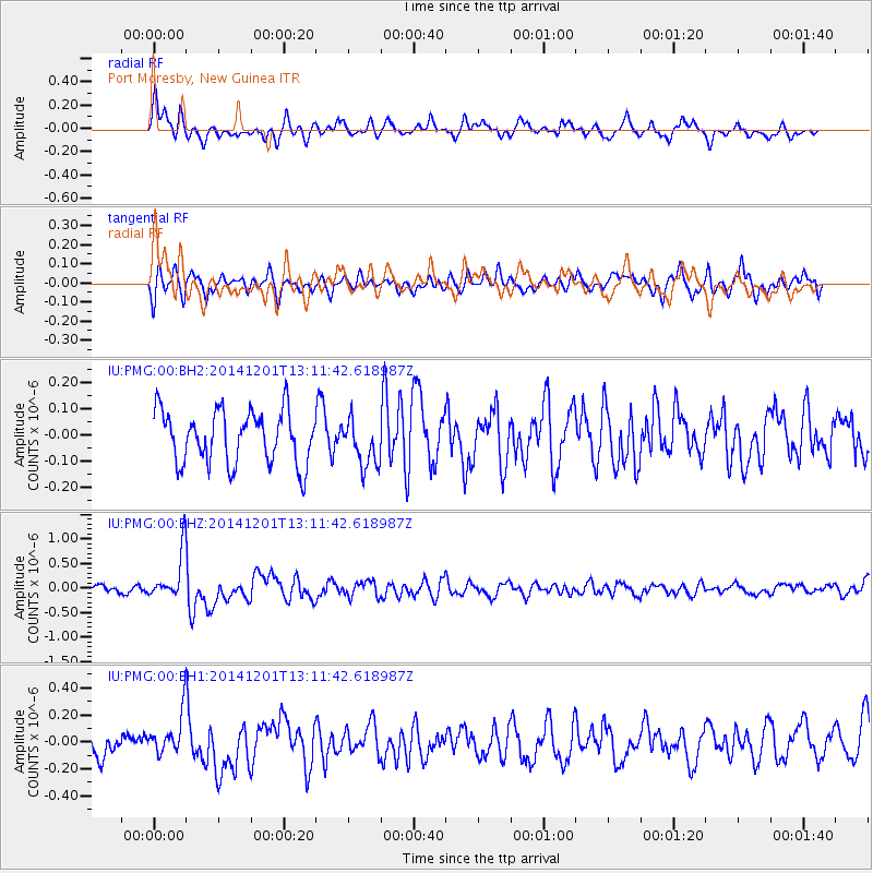
PMG Port Moresby, New Guinea - Earthquake Result Viewer
*The percent match for this event was below the threshold and hence no stack was calculated.
| Earthquake location: |
Off W. Coast Of S. Island, N.Z. |
| Earthquake latitude/longitude: |
-48.9/164.4 |
| Earthquake time(UTC): |
2014/12/01 (335) 13:04:24 GMT |
| Earthquake Depth: |
21 km |
| Earthquake Magnitude: |
5.7 MWW, 5.6 MWB, 5.6 MWC |
| Earthquake Catalog/Contributor: |
NEIC PDE/NEIC COMCAT |
|
| Network: |
IU Global Seismograph Network (GSN - IRIS/USGS) |
| Station: |
PMG Port Moresby, New Guinea |
| Lat/Lon: |
9.40 S/147.16 E |
| Elevation: |
90 m |
|
| Distance: |
41.9 deg |
| Az: |
333.964 deg |
| Baz: |
162.913 deg |
| Ray Param: |
$rayparam |
*The percent match for this event was below the threshold and hence was not used in the summary stack. |
|
| Radial Match: |
64.26448 % |
| Radial Bump: |
400 |
| Transverse Match: |
57.60171 % |
| Transverse Bump: |
400 |
| SOD ConfigId: |
827389 |
| Insert Time: |
2015-01-06 21:37:26.302 +0000 |
| GWidth: |
2.5 |
| Max Bumps: |
400 |
| Tol: |
0.001 |
|
Signal To Noise
| Channel | StoN | STA | LTA |
| IU:PMG:00:BHZ:20141201T13:11:42.618987Z | 5.4345284 | 4.9437887E-7 | 9.096997E-8 |
| IU:PMG:00:BH1:20141201T13:11:42.618987Z | 1.8303314 | 1.6043016E-7 | 8.765088E-8 |
| IU:PMG:00:BH2:20141201T13:11:42.618987Z | 0.88642913 | 8.8487454E-8 | 9.9824625E-8 |
| Arrivals |
| Ps | |
| PpPs | |
| PsPs/PpSs | |


