You are here: Home > Network List > G - GEOSCOPE Stations List
> Station INU Inuyama, Japan > Earthquake Result Viewer
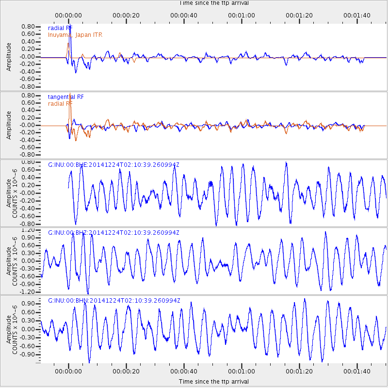
INU Inuyama, Japan - Earthquake Result Viewer
*The percent match for this event was below the threshold and hence no stack was calculated.
| Earthquake location: |
West Of Macquarie Island |
| Earthquake latitude/longitude: |
-56.4/147.2 |
| Earthquake time(UTC): |
2014/12/24 (358) 01:58:02 GMT |
| Earthquake Depth: |
10 km |
| Earthquake Magnitude: |
5.5 MB |
| Earthquake Catalog/Contributor: |
NEIC PDE/NEIC COMCAT |
|
| Network: |
G GEOSCOPE |
| Station: |
INU Inuyama, Japan |
| Lat/Lon: |
35.35 N/137.03 E |
| Elevation: |
132 m |
|
| Distance: |
91.8 deg |
| Az: |
351.658 deg |
| Baz: |
174.335 deg |
| Ray Param: |
$rayparam |
*The percent match for this event was below the threshold and hence was not used in the summary stack. |
|
| Radial Match: |
77.32021 % |
| Radial Bump: |
400 |
| Transverse Match: |
57.879337 % |
| Transverse Bump: |
400 |
| SOD ConfigId: |
827389 |
| Insert Time: |
2015-01-07 06:44:46.762 +0000 |
| GWidth: |
2.5 |
| Max Bumps: |
400 |
| Tol: |
0.001 |
|
Signal To Noise
| Channel | StoN | STA | LTA |
| G:INU:00:BHZ:20141224T02:10:39.260994Z | 2.1552787 | 6.547935E-7 | 3.0380923E-7 |
| G:INU:00:BHN:20141224T02:10:39.260994Z | 1.5557634 | 4.6532702E-7 | 2.9909884E-7 |
| G:INU:00:BHE:20141224T02:10:39.260994Z | 0.5527738 | 1.9137056E-7 | 3.462005E-7 |
| Arrivals |
| Ps | |
| PpPs | |
| PsPs/PpSs | |


