You are here: Home > Network List > GS - US Geological Survey Networks Stations List
> Station DEC06 Boomer, Decatur, IL, USA > Earthquake Result Viewer
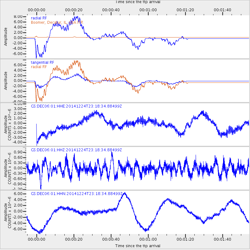
DEC06 Boomer, Decatur, IL, USA - Earthquake Result Viewer
*The percent match for this event was below the threshold and hence no stack was calculated.
| Earthquake location: |
Near East Coast Of Honshu, Japan |
| Earthquake latitude/longitude: |
37.2/141.5 |
| Earthquake time(UTC): |
2014/12/24 (358) 23:06:05 GMT |
| Earthquake Depth: |
10 km |
| Earthquake Magnitude: |
5.5 MB |
| Earthquake Catalog/Contributor: |
NEIC PDE/NEIC COMCAT |
|
| Network: |
GS US Geological Survey Networks |
| Station: |
DEC06 Boomer, Decatur, IL, USA |
| Lat/Lon: |
39.90 N/88.95 W |
| Elevation: |
215 m |
|
| Distance: |
90.3 deg |
| Az: |
36.397 deg |
| Baz: |
322.0 deg |
| Ray Param: |
$rayparam |
*The percent match for this event was below the threshold and hence was not used in the summary stack. |
|
| Radial Match: |
59.43797 % |
| Radial Bump: |
400 |
| Transverse Match: |
55.249104 % |
| Transverse Bump: |
400 |
| SOD ConfigId: |
827389 |
| Insert Time: |
2015-01-07 23:34:37.301 +0000 |
| GWidth: |
2.5 |
| Max Bumps: |
400 |
| Tol: |
0.001 |
|
Signal To Noise
| Channel | StoN | STA | LTA |
| GS:DEC06:01:HHZ:20141224T23:18:34.88499Z | 1.6960403 | 4.3221752E-7 | 2.548392E-7 |
| GS:DEC06:01:HHN:20141224T23:18:34.88499Z | 4.4041395 | 9.663084E-6 | 2.1940912E-6 |
| GS:DEC06:01:HHE:20141224T23:18:34.88499Z | 2.974895 | 3.3013212E-6 | 1.1097269E-6 |
| Arrivals |
| Ps | |
| PpPs | |
| PsPs/PpSs | |


