You are here: Home > Network List > TA - USArray Transportable Network (new EarthScope stations) Stations List
> Station J61A Chester, VT, USA > Earthquake Result Viewer
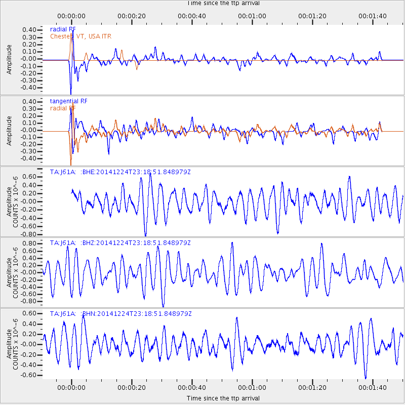
J61A Chester, VT, USA - Earthquake Result Viewer
*The percent match for this event was below the threshold and hence no stack was calculated.
| Earthquake location: |
Near East Coast Of Honshu, Japan |
| Earthquake latitude/longitude: |
37.2/141.5 |
| Earthquake time(UTC): |
2014/12/24 (358) 23:06:05 GMT |
| Earthquake Depth: |
10 km |
| Earthquake Magnitude: |
5.5 MB |
| Earthquake Catalog/Contributor: |
NEIC PDE/NEIC COMCAT |
|
| Network: |
TA USArray Transportable Network (new EarthScope stations) |
| Station: |
J61A Chester, VT, USA |
| Lat/Lon: |
43.35 N/72.55 W |
| Elevation: |
253 m |
|
| Distance: |
94.0 deg |
| Az: |
24.19 deg |
| Baz: |
333.362 deg |
| Ray Param: |
$rayparam |
*The percent match for this event was below the threshold and hence was not used in the summary stack. |
|
| Radial Match: |
68.7876 % |
| Radial Bump: |
400 |
| Transverse Match: |
58.141865 % |
| Transverse Bump: |
400 |
| SOD ConfigId: |
827389 |
| Insert Time: |
2015-01-07 23:58:04.261 +0000 |
| GWidth: |
2.5 |
| Max Bumps: |
400 |
| Tol: |
0.001 |
|
Signal To Noise
| Channel | StoN | STA | LTA |
| TA:J61A: :BHZ:20141224T23:18:51.848979Z | 1.4209113 | 4.3171337E-7 | 3.0382853E-7 |
| TA:J61A: :BHN:20141224T23:18:51.848979Z | 2.1497746 | 3.5253063E-7 | 1.6398494E-7 |
| TA:J61A: :BHE:20141224T23:18:51.848979Z | 1.2980963 | 3.0607723E-7 | 2.357893E-7 |
| Arrivals |
| Ps | |
| PpPs | |
| PsPs/PpSs | |


