
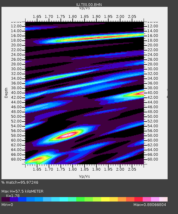
TIXI Tiksi, Russia - Earthquake Result Viewer
| ||||||||||||||||||
| ||||||||||||||||||
| ||||||||||||||||||
|
Signal To Noise
| Channel | StoN | STA | LTA |
| IU:TIXI:00:BHN:20000508T12:41:07.086028Z | 8.465317 | 1.9745217E-7 | 2.3324843E-8 |
| IU:TIXI:00:BHE:20000508T12:41:07.086028Z | 5.233338 | 1.50452E-7 | 2.8748765E-8 |
| IU:TIXI:00:BHZ:20000508T12:41:07.086028Z | 10.915098 | 7.6644335E-7 | 7.021863E-8 |
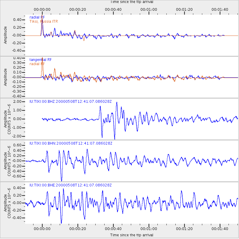
| Arrivals | |
| Ps | 7.1 SECOND |
| PpPs | 24 SECOND |
| PsPs/PpSs | 31 SECOND |

