You are here: Home > Network List > US - United States National Seismic Network Stations List
> Station LAO LASA Array, Montana, USA > Earthquake Result Viewer
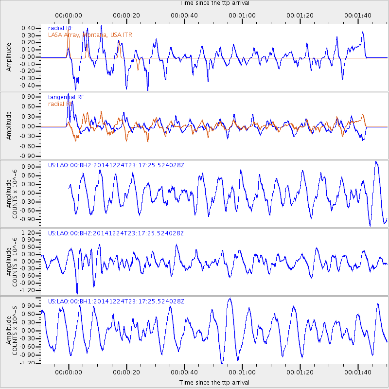
LAO LASA Array, Montana, USA - Earthquake Result Viewer
*The percent match for this event was below the threshold and hence no stack was calculated.
| Earthquake location: |
Near East Coast Of Honshu, Japan |
| Earthquake latitude/longitude: |
37.2/141.5 |
| Earthquake time(UTC): |
2014/12/24 (358) 23:06:05 GMT |
| Earthquake Depth: |
10 km |
| Earthquake Magnitude: |
5.5 MB |
| Earthquake Catalog/Contributor: |
NEIC PDE/NEIC COMCAT |
|
| Network: |
US United States National Seismic Network |
| Station: |
LAO LASA Array, Montana, USA |
| Lat/Lon: |
46.69 N/106.22 W |
| Elevation: |
902 m |
|
| Distance: |
76.8 deg |
| Az: |
40.881 deg |
| Baz: |
310.633 deg |
| Ray Param: |
$rayparam |
*The percent match for this event was below the threshold and hence was not used in the summary stack. |
|
| Radial Match: |
47.304337 % |
| Radial Bump: |
350 |
| Transverse Match: |
64.92389 % |
| Transverse Bump: |
400 |
| SOD ConfigId: |
827389 |
| Insert Time: |
2015-01-08 00:04:50.469 +0000 |
| GWidth: |
2.5 |
| Max Bumps: |
400 |
| Tol: |
0.001 |
|
Signal To Noise
| Channel | StoN | STA | LTA |
| US:LAO:00:BHZ:20141224T23:17:25.524028Z | 1.929886 | 5.111533E-7 | 2.648619E-7 |
| US:LAO:00:BH1:20141224T23:17:25.524028Z | 1.5328865 | 5.595635E-7 | 3.6503909E-7 |
| US:LAO:00:BH2:20141224T23:17:25.524028Z | 0.50940174 | 2.2045843E-7 | 4.327791E-7 |
| Arrivals |
| Ps | |
| PpPs | |
| PsPs/PpSs | |


