You are here: Home > Network List > CI - Caltech Regional Seismic Network Stations List
> Station MPM Manuel Prospect Mine, California, USA > Earthquake Result Viewer
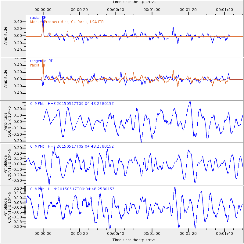
MPM Manuel Prospect Mine, California, USA - Earthquake Result Viewer
*The percent match for this event was below the threshold and hence no stack was calculated.
| Earthquake location: |
Santa Cruz Islands |
| Earthquake latitude/longitude: |
-12.2/165.8 |
| Earthquake time(UTC): |
2015/05/17 (137) 08:52:37 GMT |
| Earthquake Depth: |
18 km |
| Earthquake Magnitude: |
5.6 MW, 5.5 mb, 5.3 MS |
| Earthquake Catalog/Contributor: |
ISC/ISC |
|
| Network: |
CI Caltech Regional Seismic Network |
| Station: |
MPM Manuel Prospect Mine, California, USA |
| Lat/Lon: |
36.06 N/117.49 W |
| Elevation: |
185 m |
|
| Distance: |
86.6 deg |
| Az: |
52.182 deg |
| Baz: |
252.418 deg |
| Ray Param: |
$rayparam |
*The percent match for this event was below the threshold and hence was not used in the summary stack. |
|
| Radial Match: |
54.04469 % |
| Radial Bump: |
360 |
| Transverse Match: |
52.75624 % |
| Transverse Bump: |
400 |
| SOD ConfigId: |
7422571 |
| Insert Time: |
2019-04-18 22:24:25.407 +0000 |
| GWidth: |
2.5 |
| Max Bumps: |
400 |
| Tol: |
0.001 |
|
Signal To Noise
| Channel | StoN | STA | LTA |
| CI:MPM: :HHZ:20150517T09:04:48.258015Z | 1.6258519 | 1.8828709E-7 | 1.1580827E-7 |
| CI:MPM: :HHN:20150517T09:04:48.258015Z | 1.127346 | 9.268164E-8 | 8.221224E-8 |
| CI:MPM: :HHE:20150517T09:04:48.258015Z | 0.6437525 | 7.062779E-8 | 1.09712644E-7 |
| Arrivals |
| Ps | |
| PpPs | |
| PsPs/PpSs | |


