You are here: Home > Network List > TA - USArray Transportable Network (new EarthScope stations) Stations List
> Station J01E Myrtle Point, OR, USA > Earthquake Result Viewer
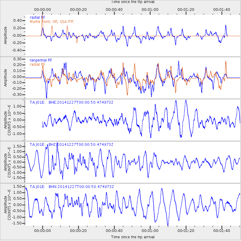
J01E Myrtle Point, OR, USA - Earthquake Result Viewer
*The percent match for this event was below the threshold and hence no stack was calculated.
| Earthquake location: |
South Of Panama |
| Earthquake latitude/longitude: |
6.5/-82.3 |
| Earthquake time(UTC): |
2014/12/26 (360) 23:52:14 GMT |
| Earthquake Depth: |
10 km |
| Earthquake Magnitude: |
5.5 MB |
| Earthquake Catalog/Contributor: |
NEIC PDE/NEIC COMCAT |
|
| Network: |
TA USArray Transportable Network (new EarthScope stations) |
| Station: |
J01E Myrtle Point, OR, USA |
| Lat/Lon: |
43.16 N/123.93 W |
| Elevation: |
128 m |
|
| Distance: |
51.6 deg |
| Az: |
321.734 deg |
| Baz: |
122.752 deg |
| Ray Param: |
$rayparam |
*The percent match for this event was below the threshold and hence was not used in the summary stack. |
|
| Radial Match: |
53.63647 % |
| Radial Bump: |
400 |
| Transverse Match: |
71.026985 % |
| Transverse Bump: |
400 |
| SOD ConfigId: |
827389 |
| Insert Time: |
2015-01-10 00:43:29.321 +0000 |
| GWidth: |
2.5 |
| Max Bumps: |
400 |
| Tol: |
0.001 |
|
Signal To Noise
| Channel | StoN | STA | LTA |
| TA:J01E: :BHZ:20141227T00:00:50.474973Z | 2.5150204 | 1.1364092E-6 | 4.518489E-7 |
| TA:J01E: :BHN:20141227T00:00:50.474973Z | 0.597925 | 4.3845097E-7 | 7.3328755E-7 |
| TA:J01E: :BHE:20141227T00:00:50.474973Z | 0.6190688 | 1.7432995E-7 | 2.8160028E-7 |
| Arrivals |
| Ps | |
| PpPs | |
| PsPs/PpSs | |


