You are here: Home > Network List > TA - USArray Transportable Network (new EarthScope stations) Stations List
> Station I23K Minto, Yukon-Koyukuk, AK, USA > Earthquake Result Viewer
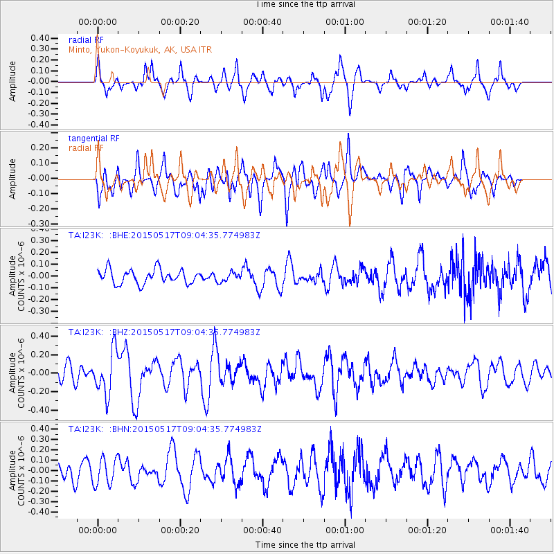
I23K Minto, Yukon-Koyukuk, AK, USA - Earthquake Result Viewer
*The percent match for this event was below the threshold and hence no stack was calculated.
| Earthquake location: |
Santa Cruz Islands |
| Earthquake latitude/longitude: |
-12.2/165.8 |
| Earthquake time(UTC): |
2015/05/17 (137) 08:52:37 GMT |
| Earthquake Depth: |
18 km |
| Earthquake Magnitude: |
5.6 MW, 5.5 mb, 5.3 MS |
| Earthquake Catalog/Contributor: |
ISC/ISC |
|
| Network: |
TA USArray Transportable Network (new EarthScope stations) |
| Station: |
I23K Minto, Yukon-Koyukuk, AK, USA |
| Lat/Lon: |
65.15 N/149.36 W |
| Elevation: |
149 m |
|
| Distance: |
84.1 deg |
| Az: |
17.43 deg |
| Baz: |
223.873 deg |
| Ray Param: |
$rayparam |
*The percent match for this event was below the threshold and hence was not used in the summary stack. |
|
| Radial Match: |
74.04913 % |
| Radial Bump: |
359 |
| Transverse Match: |
68.22729 % |
| Transverse Bump: |
400 |
| SOD ConfigId: |
7422571 |
| Insert Time: |
2019-04-18 22:26:20.514 +0000 |
| GWidth: |
2.5 |
| Max Bumps: |
400 |
| Tol: |
0.001 |
|
Signal To Noise
| Channel | StoN | STA | LTA |
| TA:I23K: :BHZ:20150517T09:04:35.774983Z | 2.4435053 | 2.4587646E-7 | 1.00624476E-7 |
| TA:I23K: :BHN:20150517T09:04:35.774983Z | 1.2388672 | 1.3013609E-7 | 1.0504442E-7 |
| TA:I23K: :BHE:20150517T09:04:35.774983Z | 0.6428194 | 3.8663142E-8 | 6.01462E-8 |
| Arrivals |
| Ps | |
| PpPs | |
| PsPs/PpSs | |


