You are here: Home > Network List > TA - USArray Transportable Network (new EarthScope stations) Stations List
> Station R11A Troy Canyon, Currant, NV, USA > Earthquake Result Viewer
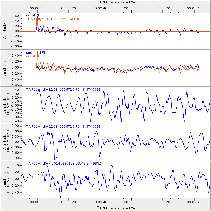
R11A Troy Canyon, Currant, NV, USA - Earthquake Result Viewer
*The percent match for this event was below the threshold and hence no stack was calculated.
| Earthquake location: |
South Of Panama |
| Earthquake latitude/longitude: |
6.5/-82.3 |
| Earthquake time(UTC): |
2014/12/26 (360) 23:52:14 GMT |
| Earthquake Depth: |
10 km |
| Earthquake Magnitude: |
5.5 MB |
| Earthquake Catalog/Contributor: |
NEIC PDE/NEIC COMCAT |
|
| Network: |
TA USArray Transportable Network (new EarthScope stations) |
| Station: |
R11A Troy Canyon, Currant, NV, USA |
| Lat/Lon: |
38.35 N/115.59 W |
| Elevation: |
1756 m |
|
| Distance: |
43.7 deg |
| Az: |
321.404 deg |
| Baz: |
127.968 deg |
| Ray Param: |
$rayparam |
*The percent match for this event was below the threshold and hence was not used in the summary stack. |
|
| Radial Match: |
62.896664 % |
| Radial Bump: |
400 |
| Transverse Match: |
51.53709 % |
| Transverse Bump: |
400 |
| SOD ConfigId: |
827389 |
| Insert Time: |
2015-01-10 00:46:28.969 +0000 |
| GWidth: |
2.5 |
| Max Bumps: |
400 |
| Tol: |
0.001 |
|
Signal To Noise
| Channel | StoN | STA | LTA |
| TA:R11A: :BHZ:20141226T23:59:48.874998Z | 1.6706098 | 2.8299343E-7 | 1.6939528E-7 |
| TA:R11A: :BHN:20141226T23:59:48.874998Z | 0.7620325 | 9.569785E-8 | 1.2558237E-7 |
| TA:R11A: :BHE:20141226T23:59:48.874998Z | 1.3596057 | 2.2434705E-7 | 1.6500891E-7 |
| Arrivals |
| Ps | |
| PpPs | |
| PsPs/PpSs | |


