You are here: Home > Network List > GS - US Geological Survey Networks Stations List
> Station KAN11 Stewart Ranch, Harper County, KS, USA > Earthquake Result Viewer
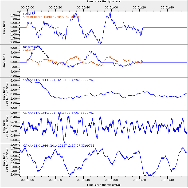
KAN11 Stewart Ranch, Harper County, KS, USA - Earthquake Result Viewer
*The percent match for this event was below the threshold and hence no stack was calculated.
| Earthquake location: |
Easter Island Region |
| Earthquake latitude/longitude: |
-29.0/-112.2 |
| Earthquake time(UTC): |
2014/12/13 (347) 12:46:44 GMT |
| Earthquake Depth: |
10 km |
| Earthquake Magnitude: |
5.5 MWC, 5.4 MWB, 5.5 MWC |
| Earthquake Catalog/Contributor: |
NEIC PDE/NEIC COMCAT |
|
| Network: |
GS US Geological Survey Networks |
| Station: |
KAN11 Stewart Ranch, Harper County, KS, USA |
| Lat/Lon: |
37.21 N/97.91 W |
| Elevation: |
410 m |
|
| Distance: |
67.2 deg |
| Az: |
12.353 deg |
| Baz: |
193.58 deg |
| Ray Param: |
$rayparam |
*The percent match for this event was below the threshold and hence was not used in the summary stack. |
|
| Radial Match: |
22.459303 % |
| Radial Bump: |
400 |
| Transverse Match: |
40.409058 % |
| Transverse Bump: |
400 |
| SOD ConfigId: |
827991 |
| Insert Time: |
2015-01-20 18:44:00.548 +0000 |
| GWidth: |
2.5 |
| Max Bumps: |
400 |
| Tol: |
0.001 |
|
Signal To Noise
| Channel | StoN | STA | LTA |
| GS:KAN11:01:HHZ:20141213T12:57:07.339976Z | 0.66803676 | 1.2649986E-7 | 1.893606E-7 |
| GS:KAN11:01:HHN:20141213T12:57:07.339976Z | 0.8552239 | 1.8504796E-6 | 2.163737E-6 |
| GS:KAN11:01:HHE:20141213T12:57:07.339976Z | 1.2466543 | 3.6743768E-6 | 2.9473904E-6 |
| Arrivals |
| Ps | |
| PpPs | |
| PsPs/PpSs | |


