You are here: Home > Network List > AV - Alaska Volcano Observatory Stations List
> Station MAPS Pakushin Southeast, Makushin Volcano, Alaska > Earthquake Result Viewer
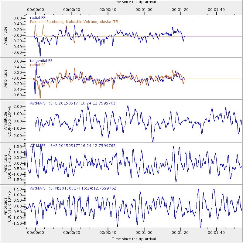
MAPS Pakushin Southeast, Makushin Volcano, Alaska - Earthquake Result Viewer
*The percent match for this event was below the threshold and hence no stack was calculated.
| Earthquake location: |
South Of Mariana Islands |
| Earthquake latitude/longitude: |
12.9/146.2 |
| Earthquake time(UTC): |
2015/05/17 (137) 16:15:15 GMT |
| Earthquake Depth: |
35 km |
| Earthquake Magnitude: |
5.1 MW, 5.2 mb, 4.5 MS |
| Earthquake Catalog/Contributor: |
ISC/ISC |
|
| Network: |
AV Alaska Volcano Observatory |
| Station: |
MAPS Pakushin Southeast, Makushin Volcano, Alaska |
| Lat/Lon: |
53.81 N/166.94 W |
| Elevation: |
333 m |
|
| Distance: |
55.0 deg |
| Az: |
31.923 deg |
| Baz: |
240.383 deg |
| Ray Param: |
$rayparam |
*The percent match for this event was below the threshold and hence was not used in the summary stack. |
|
| Radial Match: |
67.22787 % |
| Radial Bump: |
324 |
| Transverse Match: |
56.7003 % |
| Transverse Bump: |
400 |
| SOD ConfigId: |
7422571 |
| Insert Time: |
2019-04-18 22:29:47.388 +0000 |
| GWidth: |
2.5 |
| Max Bumps: |
400 |
| Tol: |
0.001 |
|
Signal To Noise
| Channel | StoN | STA | LTA |
| AV:MAPS: :BHZ:20150517T16:24:12.759976Z | 1.6637533 | 9.529126E-7 | 5.727488E-7 |
| AV:MAPS: :BHN:20150517T16:24:12.759976Z | 1.5077295 | 7.466926E-7 | 4.9524306E-7 |
| AV:MAPS: :BHE:20150517T16:24:12.759976Z | 1.8707008 | 1.0298401E-6 | 5.505103E-7 |
| Arrivals |
| Ps | |
| PpPs | |
| PsPs/PpSs | |


