You are here: Home > Network List > US - United States National Seismic Network Stations List
> Station HDIL Hopedale, Illinois, USA > Earthquake Result Viewer
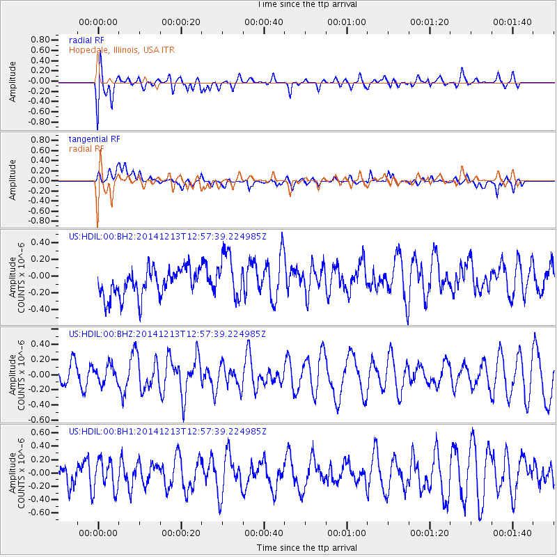
HDIL Hopedale, Illinois, USA - Earthquake Result Viewer
*The percent match for this event was below the threshold and hence no stack was calculated.
| Earthquake location: |
Easter Island Region |
| Earthquake latitude/longitude: |
-29.0/-112.2 |
| Earthquake time(UTC): |
2014/12/13 (347) 12:46:44 GMT |
| Earthquake Depth: |
10 km |
| Earthquake Magnitude: |
5.5 MWC, 5.4 MWB, 5.5 MWC |
| Earthquake Catalog/Contributor: |
NEIC PDE/NEIC COMCAT |
|
| Network: |
US United States National Seismic Network |
| Station: |
HDIL Hopedale, Illinois, USA |
| Lat/Lon: |
40.56 N/89.29 W |
| Elevation: |
219 m |
|
| Distance: |
72.4 deg |
| Az: |
18.139 deg |
| Baz: |
200.981 deg |
| Ray Param: |
$rayparam |
*The percent match for this event was below the threshold and hence was not used in the summary stack. |
|
| Radial Match: |
57.968586 % |
| Radial Bump: |
400 |
| Transverse Match: |
48.68721 % |
| Transverse Bump: |
400 |
| SOD ConfigId: |
827991 |
| Insert Time: |
2015-01-20 18:59:45.797 +0000 |
| GWidth: |
2.5 |
| Max Bumps: |
400 |
| Tol: |
0.001 |
|
Signal To Noise
| Channel | StoN | STA | LTA |
| US:HDIL:00:BHZ:20141213T12:57:39.224985Z | 0.5460782 | 1.1703404E-7 | 2.1431737E-7 |
| US:HDIL:00:BH1:20141213T12:57:39.224985Z | 0.94645184 | 2.1761785E-7 | 2.2993018E-7 |
| US:HDIL:00:BH2:20141213T12:57:39.224985Z | 1.6956056 | 2.791063E-7 | 1.6460567E-7 |
| Arrivals |
| Ps | |
| PpPs | |
| PsPs/PpSs | |


