You are here: Home > Network List > AZ - ANZA Regional Network Stations List
> Station SMER AZ.SMER > Earthquake Result Viewer
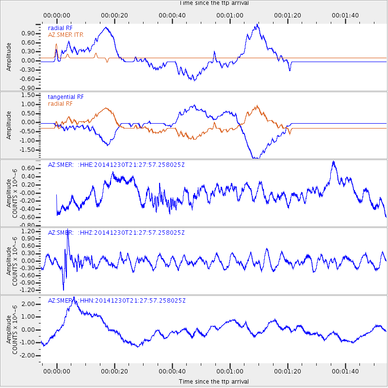
SMER AZ.SMER - Earthquake Result Viewer
*The percent match for this event was below the threshold and hence no stack was calculated.
| Earthquake location: |
Fiji Islands Region |
| Earthquake latitude/longitude: |
-20.3/-178.5 |
| Earthquake time(UTC): |
2014/12/30 (364) 21:17:23 GMT |
| Earthquake Depth: |
598 km |
| Earthquake Magnitude: |
6.1 MWB |
| Earthquake Catalog/Contributor: |
NEIC PDE/NEIC COMCAT |
|
| Network: |
AZ ANZA Regional Network |
| Station: |
SMER AZ.SMER |
| Lat/Lon: |
33.46 N/117.17 W |
| Elevation: |
355 m |
|
| Distance: |
79.3 deg |
| Az: |
48.321 deg |
| Baz: |
236.969 deg |
| Ray Param: |
$rayparam |
*The percent match for this event was below the threshold and hence was not used in the summary stack. |
|
| Radial Match: |
38.046745 % |
| Radial Bump: |
400 |
| Transverse Match: |
33.436836 % |
| Transverse Bump: |
400 |
| SOD ConfigId: |
827991 |
| Insert Time: |
2015-01-20 19:10:53.568 +0000 |
| GWidth: |
2.5 |
| Max Bumps: |
400 |
| Tol: |
0.001 |
|
Signal To Noise
| Channel | StoN | STA | LTA |
| AZ:SMER: :HHZ:20141230T21:27:57.258025Z | 3.0099738 | 5.1284144E-7 | 1.703807E-7 |
| AZ:SMER: :HHN:20141230T21:27:57.258025Z | 2.6886709 | 1.6006954E-6 | 5.9534824E-7 |
| AZ:SMER: :HHE:20141230T21:27:57.258025Z | 0.67104316 | 1.976075E-7 | 2.9447807E-7 |
| Arrivals |
| Ps | |
| PpPs | |
| PsPs/PpSs | |


