You are here: Home > Network List > BK - Berkeley Digital Seismograph Network Stations List
> Station HUMO Hull Mountain, OR > Earthquake Result Viewer
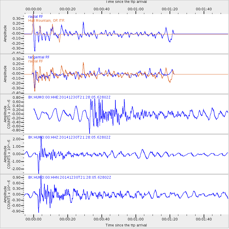
HUMO Hull Mountain, OR - Earthquake Result Viewer
*The percent match for this event was below the threshold and hence no stack was calculated.
| Earthquake location: |
Fiji Islands Region |
| Earthquake latitude/longitude: |
-20.3/-178.5 |
| Earthquake time(UTC): |
2014/12/30 (364) 21:17:23 GMT |
| Earthquake Depth: |
598 km |
| Earthquake Magnitude: |
6.1 MWB |
| Earthquake Catalog/Contributor: |
NEIC PDE/NEIC COMCAT |
|
| Network: |
BK Berkeley Digital Seismograph Network |
| Station: |
HUMO Hull Mountain, OR |
| Lat/Lon: |
42.61 N/122.96 W |
| Elevation: |
555 m |
|
| Distance: |
80.9 deg |
| Az: |
38.089 deg |
| Baz: |
231.638 deg |
| Ray Param: |
$rayparam |
*The percent match for this event was below the threshold and hence was not used in the summary stack. |
|
| Radial Match: |
67.33267 % |
| Radial Bump: |
400 |
| Transverse Match: |
52.31745 % |
| Transverse Bump: |
400 |
| SOD ConfigId: |
827991 |
| Insert Time: |
2015-01-20 19:11:14.230 +0000 |
| GWidth: |
2.5 |
| Max Bumps: |
400 |
| Tol: |
0.001 |
|
Signal To Noise
| Channel | StoN | STA | LTA |
| BK:HUMO:00:HHZ:20141230T21:28:05.62802Z | 6.1355877 | 9.640439E-7 | 1.5712332E-7 |
| BK:HUMO:00:HHN:20141230T21:28:05.62802Z | 2.2199073 | 3.4222973E-7 | 1.5416398E-7 |
| BK:HUMO:00:HHE:20141230T21:28:05.62802Z | 2.2895179 | 3.842922E-7 | 1.6784853E-7 |
| Arrivals |
| Ps | |
| PpPs | |
| PsPs/PpSs | |


