You are here: Home > Network List > CI - Caltech Regional Seismic Network Stations List
> Station DAN Danby, California, USA > Earthquake Result Viewer
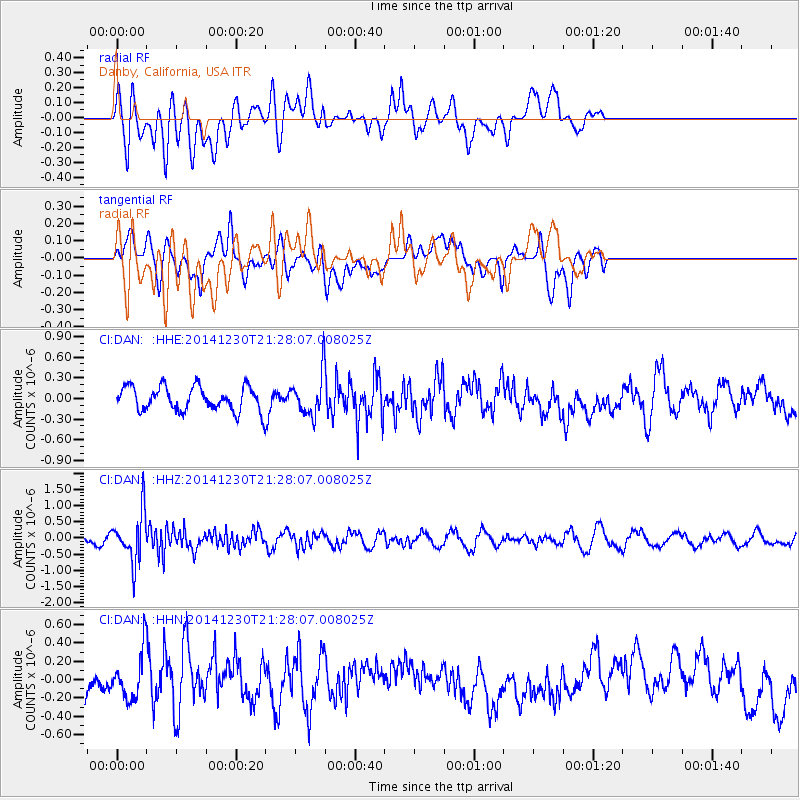
DAN Danby, California, USA - Earthquake Result Viewer
*The percent match for this event was below the threshold and hence no stack was calculated.
| Earthquake location: |
Fiji Islands Region |
| Earthquake latitude/longitude: |
-20.3/-178.5 |
| Earthquake time(UTC): |
2014/12/30 (364) 21:17:23 GMT |
| Earthquake Depth: |
598 km |
| Earthquake Magnitude: |
6.1 MWB |
| Earthquake Catalog/Contributor: |
NEIC PDE/NEIC COMCAT |
|
| Network: |
CI Caltech Regional Seismic Network |
| Station: |
DAN Danby, California, USA |
| Lat/Lon: |
34.64 N/115.38 W |
| Elevation: |
398 m |
|
| Distance: |
81.2 deg |
| Az: |
48.126 deg |
| Baz: |
237.934 deg |
| Ray Param: |
$rayparam |
*The percent match for this event was below the threshold and hence was not used in the summary stack. |
|
| Radial Match: |
50.005383 % |
| Radial Bump: |
400 |
| Transverse Match: |
33.24192 % |
| Transverse Bump: |
400 |
| SOD ConfigId: |
827991 |
| Insert Time: |
2015-01-20 19:12:43.567 +0000 |
| GWidth: |
2.5 |
| Max Bumps: |
400 |
| Tol: |
0.001 |
|
Signal To Noise
| Channel | StoN | STA | LTA |
| CI:DAN: :HHZ:20141230T21:28:07.008025Z | 4.3161206 | 7.6998043E-7 | 1.783964E-7 |
| CI:DAN: :HHN:20141230T21:28:07.008025Z | 1.1880133 | 2.505085E-7 | 2.1086338E-7 |
| CI:DAN: :HHE:20141230T21:28:07.008025Z | 1.679102 | 2.9008024E-7 | 1.7275916E-7 |
| Arrivals |
| Ps | |
| PpPs | |
| PsPs/PpSs | |


