You are here: Home > Network List > CI - Caltech Regional Seismic Network Stations List
> Station MPM Manuel Prospect Mine, California, USA > Earthquake Result Viewer
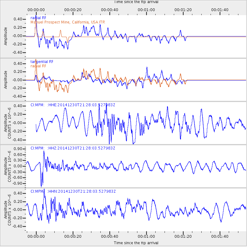
MPM Manuel Prospect Mine, California, USA - Earthquake Result Viewer
*The percent match for this event was below the threshold and hence no stack was calculated.
| Earthquake location: |
Fiji Islands Region |
| Earthquake latitude/longitude: |
-20.3/-178.5 |
| Earthquake time(UTC): |
2014/12/30 (364) 21:17:23 GMT |
| Earthquake Depth: |
598 km |
| Earthquake Magnitude: |
6.1 MWB |
| Earthquake Catalog/Contributor: |
NEIC PDE/NEIC COMCAT |
|
| Network: |
CI Caltech Regional Seismic Network |
| Station: |
MPM Manuel Prospect Mine, California, USA |
| Lat/Lon: |
36.06 N/117.49 W |
| Elevation: |
185 m |
|
| Distance: |
80.5 deg |
| Az: |
45.973 deg |
| Baz: |
236.375 deg |
| Ray Param: |
$rayparam |
*The percent match for this event was below the threshold and hence was not used in the summary stack. |
|
| Radial Match: |
61.008938 % |
| Radial Bump: |
400 |
| Transverse Match: |
46.60573 % |
| Transverse Bump: |
400 |
| SOD ConfigId: |
827991 |
| Insert Time: |
2015-01-20 19:13:32.296 +0000 |
| GWidth: |
2.5 |
| Max Bumps: |
400 |
| Tol: |
0.001 |
|
Signal To Noise
| Channel | StoN | STA | LTA |
| CI:MPM: :HHZ:20141230T21:28:03.527983Z | 3.0248368 | 4.3499E-7 | 1.438061E-7 |
| CI:MPM: :HHN:20141230T21:28:03.527983Z | 1.312283 | 2.0732726E-7 | 1.5798975E-7 |
| CI:MPM: :HHE:20141230T21:28:03.527983Z | 1.4204563 | 1.8864765E-7 | 1.3280778E-7 |
| Arrivals |
| Ps | |
| PpPs | |
| PsPs/PpSs | |


