You are here: Home > Network List > GS - US Geological Survey Networks Stations List
> Station OK031 2598 S. Brethren Rd., Cushing, OK, USA > Earthquake Result Viewer
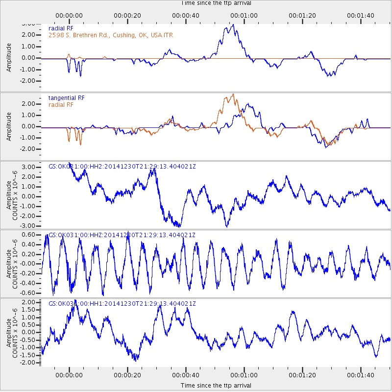
OK031 2598 S. Brethren Rd., Cushing, OK, USA - Earthquake Result Viewer
*The percent match for this event was below the threshold and hence no stack was calculated.
| Earthquake location: |
Fiji Islands Region |
| Earthquake latitude/longitude: |
-20.3/-178.5 |
| Earthquake time(UTC): |
2014/12/30 (364) 21:17:23 GMT |
| Earthquake Depth: |
598 km |
| Earthquake Magnitude: |
6.1 MWB |
| Earthquake Catalog/Contributor: |
NEIC PDE/NEIC COMCAT |
|
| Network: |
GS US Geological Survey Networks |
| Station: |
OK031 2598 S. Brethren Rd., Cushing, OK, USA |
| Lat/Lon: |
35.95 N/96.84 W |
| Elevation: |
290 m |
|
| Distance: |
95.3 deg |
| Az: |
53.738 deg |
| Baz: |
248.838 deg |
| Ray Param: |
$rayparam |
*The percent match for this event was below the threshold and hence was not used in the summary stack. |
|
| Radial Match: |
40.884674 % |
| Radial Bump: |
400 |
| Transverse Match: |
31.764215 % |
| Transverse Bump: |
400 |
| SOD ConfigId: |
827991 |
| Insert Time: |
2015-01-20 19:16:31.240 +0000 |
| GWidth: |
2.5 |
| Max Bumps: |
400 |
| Tol: |
0.001 |
|
Signal To Noise
| Channel | StoN | STA | LTA |
| GS:OK031:00:HHZ:20141230T21:29:13.404021Z | 1.1521081 | 3.445268E-7 | 2.9904035E-7 |
| GS:OK031:00:HH1:20141230T21:29:13.404021Z | 4.887435 | 2.0791467E-6 | 4.2540654E-7 |
| GS:OK031:00:HH2:20141230T21:29:13.404021Z | 2.4974427 | 2.3564808E-6 | 9.4355755E-7 |
| Arrivals |
| Ps | |
| PpPs | |
| PsPs/PpSs | |


