You are here: Home > Network List > TA - USArray Transportable Network (new EarthScope stations) Stations List
> Station L04D Klamath Falls, OR, USA > Earthquake Result Viewer
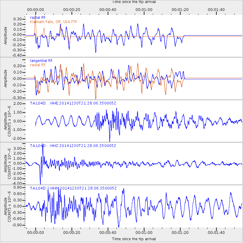
L04D Klamath Falls, OR, USA - Earthquake Result Viewer
*The percent match for this event was below the threshold and hence no stack was calculated.
| Earthquake location: |
Fiji Islands Region |
| Earthquake latitude/longitude: |
-20.3/-178.5 |
| Earthquake time(UTC): |
2014/12/30 (364) 21:17:23 GMT |
| Earthquake Depth: |
598 km |
| Earthquake Magnitude: |
6.1 MWB |
| Earthquake Catalog/Contributor: |
NEIC PDE/NEIC COMCAT |
|
| Network: |
TA USArray Transportable Network (new EarthScope stations) |
| Station: |
L04D Klamath Falls, OR, USA |
| Lat/Lon: |
42.22 N/122.30 W |
| Elevation: |
1437 m |
|
| Distance: |
81.0 deg |
| Az: |
38.7 deg |
| Baz: |
232.172 deg |
| Ray Param: |
$rayparam |
*The percent match for this event was below the threshold and hence was not used in the summary stack. |
|
| Radial Match: |
60.3399 % |
| Radial Bump: |
400 |
| Transverse Match: |
39.59919 % |
| Transverse Bump: |
400 |
| SOD ConfigId: |
827991 |
| Insert Time: |
2015-01-20 19:25:00.970 +0000 |
| GWidth: |
2.5 |
| Max Bumps: |
400 |
| Tol: |
0.001 |
|
Signal To Noise
| Channel | StoN | STA | LTA |
| TA:L04D: :HHZ:20141230T21:28:06.350005Z | 6.5103445 | 1.4436781E-6 | 2.2175143E-7 |
| TA:L04D: :HHN:20141230T21:28:06.350005Z | 0.46032667 | 1.6843771E-7 | 3.6590907E-7 |
| TA:L04D: :HHE:20141230T21:28:06.350005Z | 1.2690998 | 4.8907447E-7 | 3.8537118E-7 |
| Arrivals |
| Ps | |
| PpPs | |
| PsPs/PpSs | |


