You are here: Home > Network List > GS - US Geological Survey Networks Stations List
> Station KAN10 Keim Farm > Earthquake Result Viewer
KAN10 Keim Farm - Earthquake Result Viewer
*The percent match for this event was below the threshold and hence no stack was calculated.
| Earthquake location: |
Kuril Islands |
| Earthquake latitude/longitude: |
44.5/146.5 |
| Earthquake time(UTC): |
2015/05/17 (137) 17:26:02 GMT |
| Earthquake Depth: |
168 km |
| Earthquake Magnitude: |
3.6 mb |
| Earthquake Catalog/Contributor: |
ISC/ISC |
|
| Network: |
GS US Geological Survey Networks |
| Station: |
KAN10 Keim Farm |
| Lat/Lon: |
37.12 N/98.10 W |
| Elevation: |
417 m |
|
| Distance: |
79.9 deg |
| Az: |
47.167 deg |
| Baz: |
318.995 deg |
| Ray Param: |
$rayparam |
*The percent match for this event was below the threshold and hence was not used in the summary stack. |
|
| Radial Match: |
75.82556 % |
| Radial Bump: |
400 |
| Transverse Match: |
76.94754 % |
| Transverse Bump: |
400 |
| SOD ConfigId: |
7422571 |
| Insert Time: |
2019-04-18 22:37:16.050 +0000 |
| GWidth: |
2.5 |
| Max Bumps: |
400 |
| Tol: |
0.001 |
|
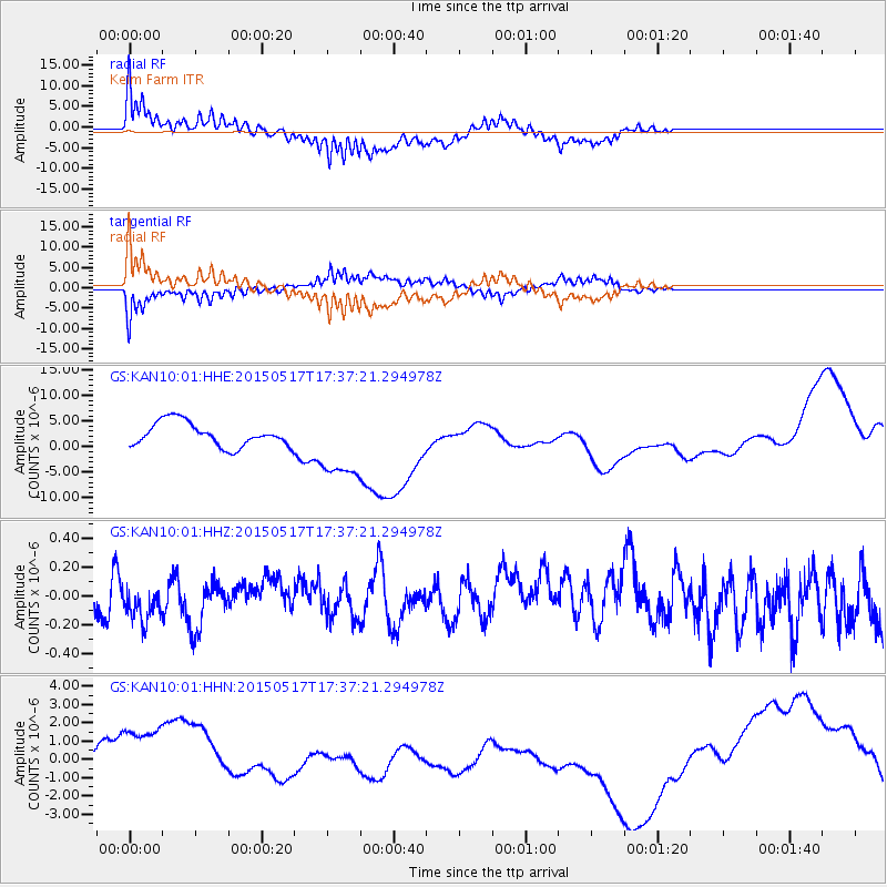
Signal To Noise
| Channel | StoN | STA | LTA |
| GS:KAN10:01:HHZ:20150517T17:37:21.294978Z | 0.97040665 | 1.3952267E-7 | 1.4377753E-7 |
| GS:KAN10:01:HHN:20150517T17:37:21.294978Z | 2.9284554 | 2.6867003E-6 | 9.174463E-7 |
| GS:KAN10:01:HHE:20150517T17:37:21.294978Z | 2.9961026 | 7.0056417E-6 | 2.3382515E-6 |
| Arrivals |
| Ps | |
| PpPs | |
| PsPs/PpSs | |


