You are here: Home > Network List > TA - USArray Transportable Network (new EarthScope stations) Stations List
> Station O03E Paynes Creek, CA, USA > Earthquake Result Viewer
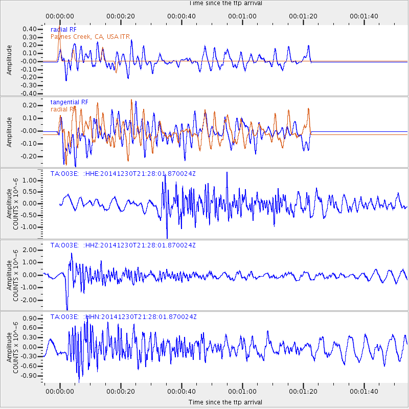
O03E Paynes Creek, CA, USA - Earthquake Result Viewer
*The percent match for this event was below the threshold and hence no stack was calculated.
| Earthquake location: |
Fiji Islands Region |
| Earthquake latitude/longitude: |
-20.3/-178.5 |
| Earthquake time(UTC): |
2014/12/30 (364) 21:17:23 GMT |
| Earthquake Depth: |
598 km |
| Earthquake Magnitude: |
6.1 MWB |
| Earthquake Catalog/Contributor: |
NEIC PDE/NEIC COMCAT |
|
| Network: |
TA USArray Transportable Network (new EarthScope stations) |
| Station: |
O03E Paynes Creek, CA, USA |
| Lat/Lon: |
40.29 N/121.80 W |
| Elevation: |
967 m |
|
| Distance: |
80.2 deg |
| Az: |
40.479 deg |
| Baz: |
232.793 deg |
| Ray Param: |
$rayparam |
*The percent match for this event was below the threshold and hence was not used in the summary stack. |
|
| Radial Match: |
66.883224 % |
| Radial Bump: |
400 |
| Transverse Match: |
52.776222 % |
| Transverse Bump: |
400 |
| SOD ConfigId: |
827991 |
| Insert Time: |
2015-01-20 19:25:17.556 +0000 |
| GWidth: |
2.5 |
| Max Bumps: |
400 |
| Tol: |
0.001 |
|
Signal To Noise
| Channel | StoN | STA | LTA |
| TA:O03E: :HHZ:20141230T21:28:01.870024Z | 8.628667 | 1.0088569E-6 | 1.169192E-7 |
| TA:O03E: :HHN:20141230T21:28:01.870024Z | 1.1560822 | 2.483726E-7 | 2.1483993E-7 |
| TA:O03E: :HHE:20141230T21:28:01.870024Z | 2.43843 | 4.3559731E-7 | 1.7863844E-7 |
| Arrivals |
| Ps | |
| PpPs | |
| PsPs/PpSs | |


