You are here: Home > Network List > TA - USArray Transportable Network (new EarthScope stations) Stations List
> Station A21K Barrow, AK, USA > Earthquake Result Viewer
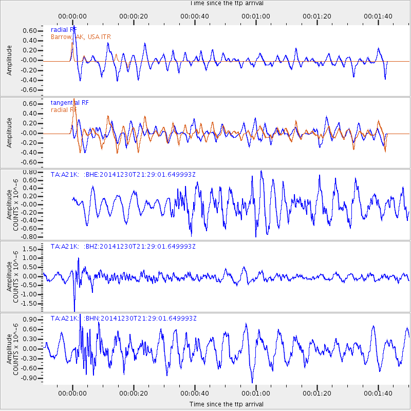
A21K Barrow, AK, USA - Earthquake Result Viewer
*The percent match for this event was below the threshold and hence no stack was calculated.
| Earthquake location: |
Fiji Islands Region |
| Earthquake latitude/longitude: |
-20.3/-178.5 |
| Earthquake time(UTC): |
2014/12/30 (364) 21:17:23 GMT |
| Earthquake Depth: |
598 km |
| Earthquake Magnitude: |
6.1 MWB |
| Earthquake Catalog/Contributor: |
NEIC PDE/NEIC COMCAT |
|
| Network: |
TA USArray Transportable Network (new EarthScope stations) |
| Station: |
A21K Barrow, AK, USA |
| Lat/Lon: |
71.32 N/156.62 W |
| Elevation: |
577 m |
|
| Distance: |
92.7 deg |
| Az: |
6.919 deg |
| Baz: |
200.539 deg |
| Ray Param: |
$rayparam |
*The percent match for this event was below the threshold and hence was not used in the summary stack. |
|
| Radial Match: |
70.40212 % |
| Radial Bump: |
400 |
| Transverse Match: |
52.492363 % |
| Transverse Bump: |
400 |
| SOD ConfigId: |
827991 |
| Insert Time: |
2015-01-20 19:25:40.630 +0000 |
| GWidth: |
2.5 |
| Max Bumps: |
400 |
| Tol: |
0.001 |
|
Signal To Noise
| Channel | StoN | STA | LTA |
| TA:A21K: :BHZ:20141230T21:29:01.649993Z | 3.1734402 | 5.6166266E-7 | 1.7698856E-7 |
| TA:A21K: :BHN:20141230T21:29:01.649993Z | 2.152805 | 3.743099E-7 | 1.7387079E-7 |
| TA:A21K: :BHE:20141230T21:29:01.649993Z | 0.84582347 | 1.8323415E-7 | 2.1663404E-7 |
| Arrivals |
| Ps | |
| PpPs | |
| PsPs/PpSs | |


