You are here: Home > Network List > TA - USArray Transportable Network (new EarthScope stations) Stations List
> Station WHTX Lake Whitney, Meridian, TX, USA > Earthquake Result Viewer
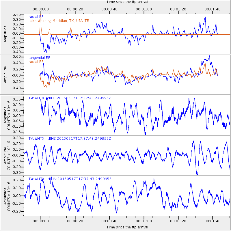
WHTX Lake Whitney, Meridian, TX, USA - Earthquake Result Viewer
*The percent match for this event was below the threshold and hence no stack was calculated.
| Earthquake location: |
Kuril Islands |
| Earthquake latitude/longitude: |
44.5/146.5 |
| Earthquake time(UTC): |
2015/05/17 (137) 17:26:02 GMT |
| Earthquake Depth: |
168 km |
| Earthquake Magnitude: |
3.6 mb |
| Earthquake Catalog/Contributor: |
ISC/ISC |
|
| Network: |
TA USArray Transportable Network (new EarthScope stations) |
| Station: |
WHTX Lake Whitney, Meridian, TX, USA |
| Lat/Lon: |
31.99 N/97.46 W |
| Elevation: |
190 m |
|
| Distance: |
84.2 deg |
| Az: |
50.128 deg |
| Baz: |
319.766 deg |
| Ray Param: |
$rayparam |
*The percent match for this event was below the threshold and hence was not used in the summary stack. |
|
| Radial Match: |
46.18707 % |
| Radial Bump: |
400 |
| Transverse Match: |
45.379734 % |
| Transverse Bump: |
400 |
| SOD ConfigId: |
7422571 |
| Insert Time: |
2019-04-18 22:40:37.198 +0000 |
| GWidth: |
2.5 |
| Max Bumps: |
400 |
| Tol: |
0.001 |
|
Signal To Noise
| Channel | StoN | STA | LTA |
| TA:WHTX: :BHZ:20150517T17:37:43.249995Z | 1.6147698 | 1.382938E-7 | 8.5643045E-8 |
| TA:WHTX: :BHN:20150517T17:37:43.249995Z | 1.4982529 | 1.4098039E-7 | 9.409653E-8 |
| TA:WHTX: :BHE:20150517T17:37:43.249995Z | 1.1176454 | 6.821488E-8 | 6.1034456E-8 |
| Arrivals |
| Ps | |
| PpPs | |
| PsPs/PpSs | |


