You are here: Home > Network List > UW - Pacific Northwest Regional Seismic Network Stations List
> Station MRBL Marblemount, WA, USA > Earthquake Result Viewer
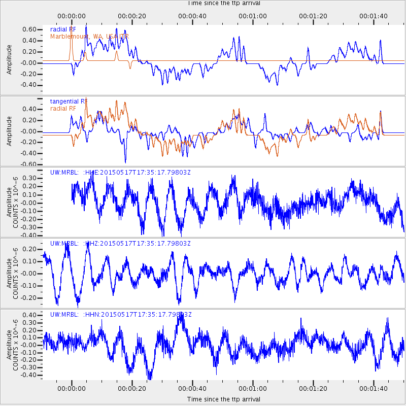
MRBL Marblemount, WA, USA - Earthquake Result Viewer
*The percent match for this event was below the threshold and hence no stack was calculated.
| Earthquake location: |
Kuril Islands |
| Earthquake latitude/longitude: |
44.5/146.5 |
| Earthquake time(UTC): |
2015/05/17 (137) 17:26:02 GMT |
| Earthquake Depth: |
168 km |
| Earthquake Magnitude: |
3.6 mb |
| Earthquake Catalog/Contributor: |
ISC/ISC |
|
| Network: |
UW Pacific Northwest Regional Seismic Network |
| Station: |
MRBL Marblemount, WA, USA |
| Lat/Lon: |
48.52 N/121.48 W |
| Elevation: |
75 m |
|
| Distance: |
59.6 deg |
| Az: |
50.361 deg |
| Baz: |
304.077 deg |
| Ray Param: |
$rayparam |
*The percent match for this event was below the threshold and hence was not used in the summary stack. |
|
| Radial Match: |
50.801365 % |
| Radial Bump: |
400 |
| Transverse Match: |
65.79546 % |
| Transverse Bump: |
400 |
| SOD ConfigId: |
7422571 |
| Insert Time: |
2019-04-18 22:41:20.475 +0000 |
| GWidth: |
2.5 |
| Max Bumps: |
400 |
| Tol: |
0.001 |
|
Signal To Noise
| Channel | StoN | STA | LTA |
| UW:MRBL: :HHZ:20150517T17:35:17.79803Z | 1.457793 | 1.4293109E-7 | 9.8046215E-8 |
| UW:MRBL: :HHN:20150517T17:35:17.79803Z | 0.9560368 | 1.03676605E-7 | 1.08444155E-7 |
| UW:MRBL: :HHE:20150517T17:35:17.79803Z | 1.5436943 | 2.2504783E-7 | 1.4578524E-7 |
| Arrivals |
| Ps | |
| PpPs | |
| PsPs/PpSs | |


