You are here: Home > Network List > UW - Pacific Northwest Regional Seismic Network Stations List
> Station PASS Maple Falls, WA, USA > Earthquake Result Viewer
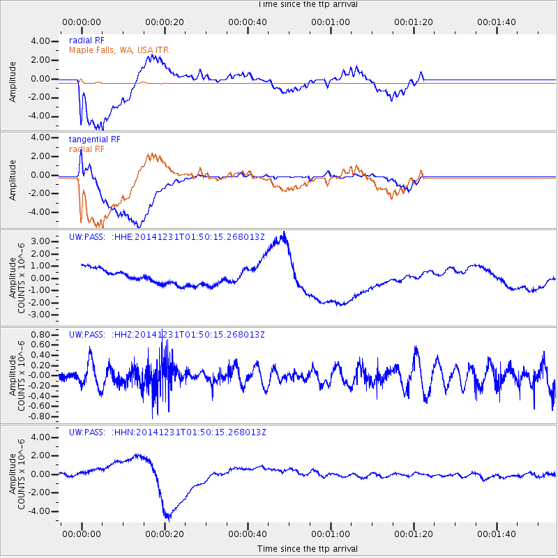
PASS Maple Falls, WA, USA - Earthquake Result Viewer
*The percent match for this event was below the threshold and hence no stack was calculated.
| Earthquake location: |
Near N Coast Of New Guinea, P.N.G. |
| Earthquake latitude/longitude: |
-4.4/144.0 |
| Earthquake time(UTC): |
2014/12/31 (365) 01:37:33 GMT |
| Earthquake Depth: |
123 km |
| Earthquake Magnitude: |
5.8 MWW, 5.8 MWC, 5.8 MWB |
| Earthquake Catalog/Contributor: |
NEIC PDE/NEIC COMCAT |
|
| Network: |
UW Pacific Northwest Regional Seismic Network |
| Station: |
PASS Maple Falls, WA, USA |
| Lat/Lon: |
49.00 N/122.09 W |
| Elevation: |
174 m |
|
| Distance: |
95.9 deg |
| Az: |
41.341 deg |
| Baz: |
270.033 deg |
| Ray Param: |
$rayparam |
*The percent match for this event was below the threshold and hence was not used in the summary stack. |
|
| Radial Match: |
62.138855 % |
| Radial Bump: |
400 |
| Transverse Match: |
56.64019 % |
| Transverse Bump: |
400 |
| SOD ConfigId: |
827991 |
| Insert Time: |
2015-01-20 19:44:36.583 +0000 |
| GWidth: |
2.5 |
| Max Bumps: |
400 |
| Tol: |
0.001 |
|
Signal To Noise
| Channel | StoN | STA | LTA |
| UW:PASS: :HHZ:20141231T01:50:15.268013Z | 2.637798 | 2.5238037E-7 | 9.567843E-8 |
| UW:PASS: :HHN:20141231T01:50:15.268013Z | 1.2856519 | 4.247354E-7 | 3.303658E-7 |
| UW:PASS: :HHE:20141231T01:50:15.268013Z | 1.1778203 | 6.5133855E-7 | 5.530033E-7 |
| Arrivals |
| Ps | |
| PpPs | |
| PsPs/PpSs | |


