TIXI Tiksi, Russia - Earthquake Result Viewer
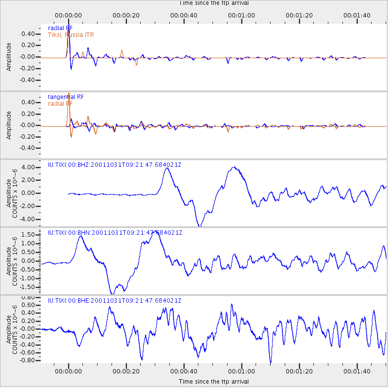
Earthquake location: New Britain Region, P.N.G.
Earthquake latitude/longitude: -5.9/150.2
Earthquake time(UTC): 2001/10/31 (304) 09:10:20 GMT
Earthquake Depth: 33 km
Earthquake Magnitude: 5.9 MB, 6.9 MS, 6.9 MW, 6.9 MW
Earthquake Catalog/Contributor: WHDF/NEIC
Network: IU Global Seismograph Network (GSN - IRIS/USGS)
Station: TIXI Tiksi, Russia
Lat/Lon: 71.65 N/128.87 E
Elevation: 50 m
Distance: 78.7 deg
Az: 353.252 deg
Baz: 158.345 deg
Ray Param: 0.049438216
Estimated Moho Depth: 15.0 km
Estimated Crust Vp/Vs: 2.10
Assumed Crust Vp: 6.552 km/s
Estimated Crust Vs: 3.124 km/s
Estimated Crust Poisson's Ratio: 0.35
Radial Match: 97.86795 %
Radial Bump: 354
Transverse Match: 91.18181 %
Transverse Bump: 400
SOD ConfigId: 20082
Insert Time: 2010-03-02 14:59:47.279 +0000
GWidth: 2.5
Max Bumps: 400
Tol: 0.001

Signal To Noise

ChannelStoNSTALTA
IU:TIXI:00:BHN:20011031T09:21:47.684021Z12.5738558.4604847E-76.728632E-8
IU:TIXI:00:BHE:20011031T09:21:47.684021Z4.4203422.3450275E-75.3050815E-8
IU:TIXI:00:BHZ:20011031T09:21:47.684021Z29.779452.3175319E-67.7823195E-8
Arrivals
Ps2.6 SECOND
PpPs6.9 SECOND
PsPs/PpSs9.5 SECOND