You are here: Home > Network List > IU - Global Seismograph Network (GSN - IRIS/USGS) Stations List
> Station XMAS Kiritimati Island, Republic of Kiribati > Earthquake Result Viewer
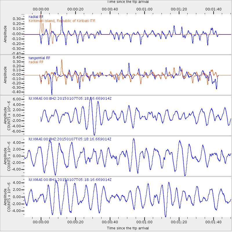
XMAS Kiritimati Island, Republic of Kiribati - Earthquake Result Viewer
*The percent match for this event was below the threshold and hence no stack was calculated.
| Earthquake location: |
South Of Panama |
| Earthquake latitude/longitude: |
5.8/-82.7 |
| Earthquake time(UTC): |
2015/01/07 (007) 05:07:08 GMT |
| Earthquake Depth: |
10 km |
| Earthquake Magnitude: |
6.6 MWP, 6.6 MI |
| Earthquake Catalog/Contributor: |
NEIC PDE/NEIC COMCAT |
|
| Network: |
IU Global Seismograph Network (GSN - IRIS/USGS) |
| Station: |
XMAS Kiritimati Island, Republic of Kiribati |
| Lat/Lon: |
2.04 N/157.45 W |
| Elevation: |
20 m |
|
| Distance: |
74.7 deg |
| Az: |
270.524 deg |
| Baz: |
84.552 deg |
| Ray Param: |
$rayparam |
*The percent match for this event was below the threshold and hence was not used in the summary stack. |
|
| Radial Match: |
45.216476 % |
| Radial Bump: |
400 |
| Transverse Match: |
54.441357 % |
| Transverse Bump: |
397 |
| SOD ConfigId: |
827991 |
| Insert Time: |
2015-01-21 05:38:35.607 +0000 |
| GWidth: |
2.5 |
| Max Bumps: |
400 |
| Tol: |
0.001 |
|
Signal To Noise
| Channel | StoN | STA | LTA |
| IU:XMAS:00:BHZ:20150107T05:18:16.669014Z | 1.8960247 | 2.8948577E-6 | 1.5268038E-6 |
| IU:XMAS:00:BH1:20150107T05:18:16.669014Z | 0.8760435 | 1.5090452E-6 | 1.7225688E-6 |
| IU:XMAS:00:BH2:20150107T05:18:16.669014Z | 2.6564138 | 4.407727E-6 | 1.6592772E-6 |
| Arrivals |
| Ps | |
| PpPs | |
| PsPs/PpSs | |


