You are here: Home > Network List > TA - USArray Transportable Network (new EarthScope stations) Stations List
> Station J61A Chester, VT, USA > Earthquake Result Viewer
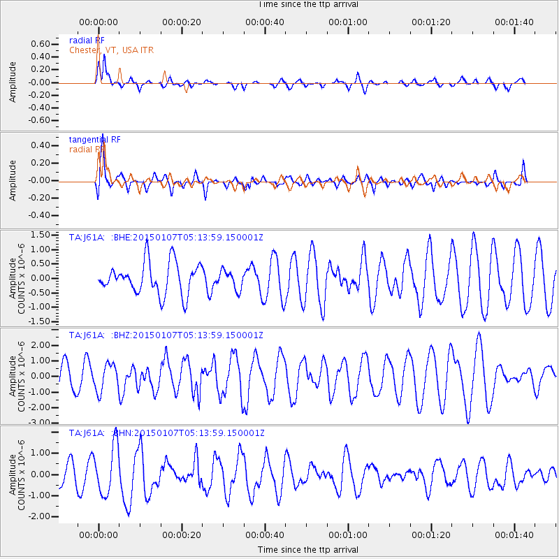
J61A Chester, VT, USA - Earthquake Result Viewer
*The percent match for this event was below the threshold and hence no stack was calculated.
| Earthquake location: |
South Of Panama |
| Earthquake latitude/longitude: |
5.8/-82.7 |
| Earthquake time(UTC): |
2015/01/07 (007) 05:07:08 GMT |
| Earthquake Depth: |
10 km |
| Earthquake Magnitude: |
6.6 MWP, 6.6 MI |
| Earthquake Catalog/Contributor: |
NEIC PDE/NEIC COMCAT |
|
| Network: |
TA USArray Transportable Network (new EarthScope stations) |
| Station: |
J61A Chester, VT, USA |
| Lat/Lon: |
43.35 N/72.55 W |
| Elevation: |
253 m |
|
| Distance: |
38.4 deg |
| Az: |
11.881 deg |
| Baz: |
196.306 deg |
| Ray Param: |
$rayparam |
*The percent match for this event was below the threshold and hence was not used in the summary stack. |
|
| Radial Match: |
76.886536 % |
| Radial Bump: |
398 |
| Transverse Match: |
55.83236 % |
| Transverse Bump: |
400 |
| SOD ConfigId: |
827991 |
| Insert Time: |
2015-01-21 05:47:15.840 +0000 |
| GWidth: |
2.5 |
| Max Bumps: |
400 |
| Tol: |
0.001 |
|
Signal To Noise
| Channel | StoN | STA | LTA |
| TA:J61A: :BHZ:20150107T05:13:59.150001Z | 1.3939855 | 8.9009063E-7 | 6.385222E-7 |
| TA:J61A: :BHN:20150107T05:13:59.150001Z | 3.4845119 | 1.1744352E-6 | 3.3704438E-7 |
| TA:J61A: :BHE:20150107T05:13:59.150001Z | 0.6183309 | 3.3487754E-7 | 5.4158306E-7 |
| Arrivals |
| Ps | |
| PpPs | |
| PsPs/PpSs | |


