You are here: Home > Network List > UW - Pacific Northwest Regional Seismic Network Stations List
> Station UMAT Pilot Rock, OR, USA > Earthquake Result Viewer
UMAT Pilot Rock, OR, USA - Earthquake Result Viewer
*The percent match for this event was below the threshold and hence no stack was calculated.
| Earthquake location: |
South Of Panama |
| Earthquake latitude/longitude: |
5.8/-82.7 |
| Earthquake time(UTC): |
2015/01/07 (007) 05:07:08 GMT |
| Earthquake Depth: |
10 km |
| Earthquake Magnitude: |
6.6 MWP, 6.6 MI |
| Earthquake Catalog/Contributor: |
NEIC PDE/NEIC COMCAT |
|
| Network: |
UW Pacific Northwest Regional Seismic Network |
| Station: |
UMAT Pilot Rock, OR, USA |
| Lat/Lon: |
45.29 N/118.96 W |
| Elevation: |
1318 m |
|
| Distance: |
50.4 deg |
| Az: |
327.15 deg |
| Baz: |
130.135 deg |
| Ray Param: |
$rayparam |
*The percent match for this event was below the threshold and hence was not used in the summary stack. |
|
| Radial Match: |
51.143528 % |
| Radial Bump: |
348 |
| Transverse Match: |
34.141445 % |
| Transverse Bump: |
280 |
| SOD ConfigId: |
827991 |
| Insert Time: |
2015-01-21 05:51:20.496 +0000 |
| GWidth: |
2.5 |
| Max Bumps: |
400 |
| Tol: |
0.001 |
|
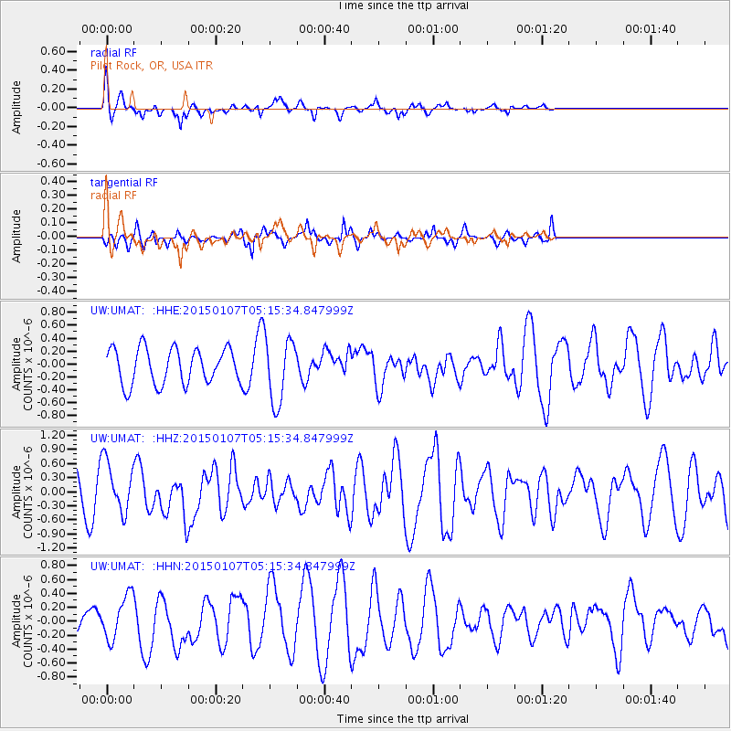
Signal To Noise
| Channel | StoN | STA | LTA |
| UW:UMAT: :HHZ:20150107T05:15:34.847999Z | 1.4742898 | 5.455931E-7 | 3.700718E-7 |
| UW:UMAT: :HHN:20150107T05:15:34.847999Z | 0.928053 | 3.1057147E-7 | 3.346484E-7 |
| UW:UMAT: :HHE:20150107T05:15:34.847999Z | 1.8223453 | 4.975454E-7 | 2.7302477E-7 |
| Arrivals |
| Ps | |
| PpPs | |
| PsPs/PpSs | |


