You are here: Home > Network List > CI - Caltech Regional Seismic Network Stations List
> Station MPM Manuel Prospect Mine, California, USA > Earthquake Result Viewer
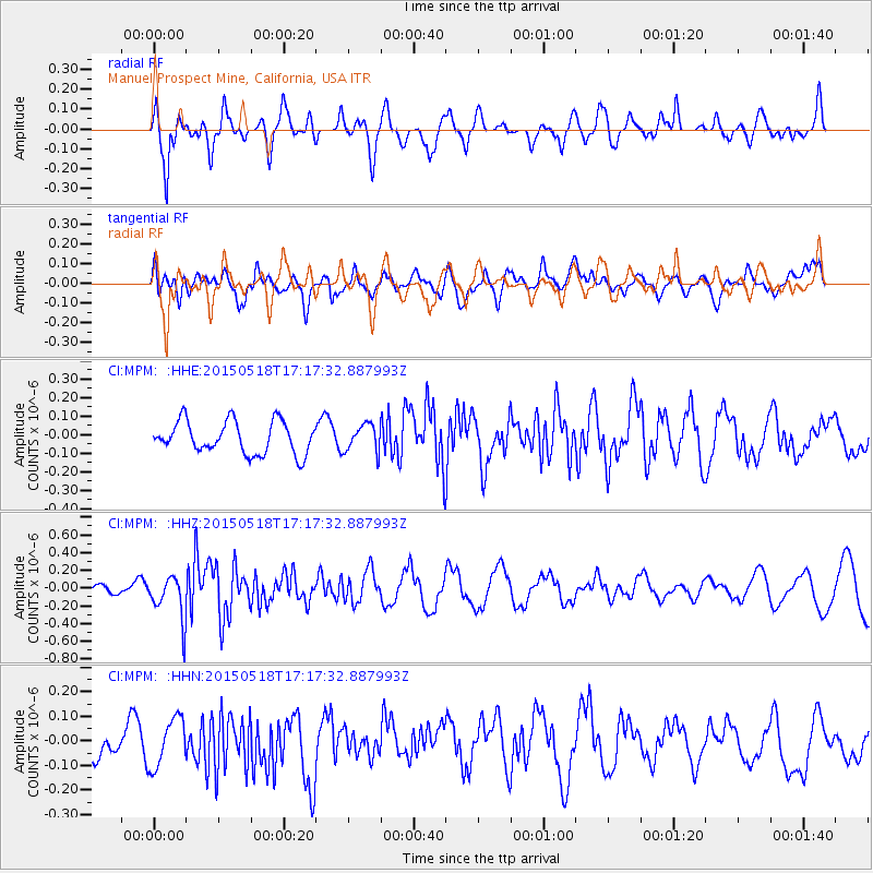
MPM Manuel Prospect Mine, California, USA - Earthquake Result Viewer
*The percent match for this event was below the threshold and hence no stack was calculated.
| Earthquake location: |
Solomon Islands |
| Earthquake latitude/longitude: |
-7.2/154.4 |
| Earthquake time(UTC): |
2015/05/18 (138) 17:04:52 GMT |
| Earthquake Depth: |
10 km |
| Earthquake Magnitude: |
5.7 MWC, 5.6 MWB, 5.7 MWC |
| Earthquake Catalog/Contributor: |
NEIC PDE/NEIC COMCAT |
|
| Network: |
CI Caltech Regional Seismic Network |
| Station: |
MPM Manuel Prospect Mine, California, USA |
| Lat/Lon: |
36.06 N/117.49 W |
| Elevation: |
185 m |
|
| Distance: |
92.6 deg |
| Az: |
54.162 deg |
| Baz: |
263.09 deg |
| Ray Param: |
$rayparam |
*The percent match for this event was below the threshold and hence was not used in the summary stack. |
|
| Radial Match: |
78.94151 % |
| Radial Bump: |
400 |
| Transverse Match: |
42.922695 % |
| Transverse Bump: |
400 |
| SOD ConfigId: |
7422571 |
| Insert Time: |
2019-04-18 22:59:07.056 +0000 |
| GWidth: |
2.5 |
| Max Bumps: |
400 |
| Tol: |
0.001 |
|
Signal To Noise
| Channel | StoN | STA | LTA |
| CI:MPM: :HHZ:20150518T17:17:32.887993Z | 4.3745494 | 2.4766135E-7 | 5.661414E-8 |
| CI:MPM: :HHN:20150518T17:17:32.887993Z | 1.4069606 | 1.0038109E-7 | 7.134606E-8 |
| CI:MPM: :HHE:20150518T17:17:32.887993Z | 0.859922 | 7.454106E-8 | 8.6683514E-8 |
| Arrivals |
| Ps | |
| PpPs | |
| PsPs/PpSs | |


