You are here: Home > Network List > TA - USArray Transportable Network (new EarthScope stations) Stations List
> Station A21K Barrow, AK, USA > Earthquake Result Viewer
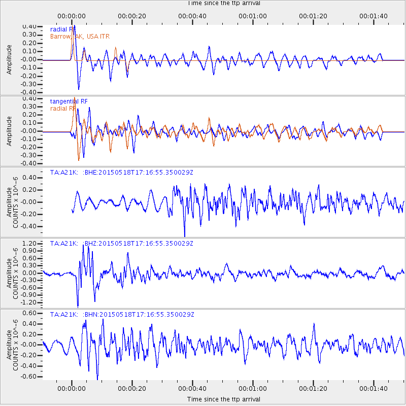
A21K Barrow, AK, USA - Earthquake Result Viewer
*The percent match for this event was below the threshold and hence no stack was calculated.
| Earthquake location: |
Solomon Islands |
| Earthquake latitude/longitude: |
-7.2/154.4 |
| Earthquake time(UTC): |
2015/05/18 (138) 17:04:52 GMT |
| Earthquake Depth: |
10 km |
| Earthquake Magnitude: |
5.7 MWC, 5.6 MWB, 5.7 MWC |
| Earthquake Catalog/Contributor: |
NEIC PDE/NEIC COMCAT |
|
| Network: |
TA USArray Transportable Network (new EarthScope stations) |
| Station: |
A21K Barrow, AK, USA |
| Lat/Lon: |
71.32 N/156.62 W |
| Elevation: |
577 m |
|
| Distance: |
84.7 deg |
| Az: |
14.121 deg |
| Baz: |
228.711 deg |
| Ray Param: |
$rayparam |
*The percent match for this event was below the threshold and hence was not used in the summary stack. |
|
| Radial Match: |
75.35071 % |
| Radial Bump: |
400 |
| Transverse Match: |
77.59825 % |
| Transverse Bump: |
400 |
| SOD ConfigId: |
7422571 |
| Insert Time: |
2019-04-18 23:01:10.500 +0000 |
| GWidth: |
2.5 |
| Max Bumps: |
400 |
| Tol: |
0.001 |
|
Signal To Noise
| Channel | StoN | STA | LTA |
| TA:A21K: :BHZ:20150518T17:16:55.350029Z | 7.7915573 | 5.060435E-7 | 6.494767E-8 |
| TA:A21K: :BHN:20150518T17:16:55.350029Z | 3.8746247 | 2.34101E-7 | 6.041901E-8 |
| TA:A21K: :BHE:20150518T17:16:55.350029Z | 1.9084088 | 1.3507305E-7 | 7.077784E-8 |
| Arrivals |
| Ps | |
| PpPs | |
| PsPs/PpSs | |


