You are here: Home > Network List > TA - USArray Transportable Network (new EarthScope stations) Stations List
> Station J01E Myrtle Point, OR, USA > Earthquake Result Viewer
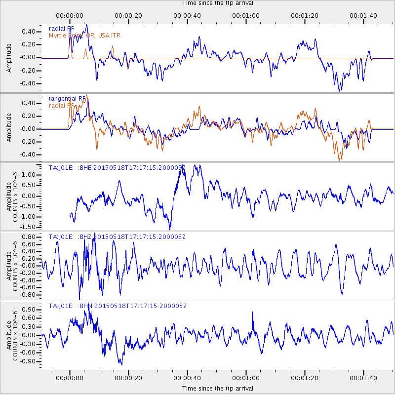
J01E Myrtle Point, OR, USA - Earthquake Result Viewer
*The percent match for this event was below the threshold and hence no stack was calculated.
| Earthquake location: |
Solomon Islands |
| Earthquake latitude/longitude: |
-7.2/154.4 |
| Earthquake time(UTC): |
2015/05/18 (138) 17:04:52 GMT |
| Earthquake Depth: |
10 km |
| Earthquake Magnitude: |
5.7 MWC, 5.6 MWB, 5.7 MWC |
| Earthquake Catalog/Contributor: |
NEIC PDE/NEIC COMCAT |
|
| Network: |
TA USArray Transportable Network (new EarthScope stations) |
| Station: |
J01E Myrtle Point, OR, USA |
| Lat/Lon: |
43.16 N/123.93 W |
| Elevation: |
128 m |
|
| Distance: |
88.8 deg |
| Az: |
46.392 deg |
| Baz: |
259.084 deg |
| Ray Param: |
$rayparam |
*The percent match for this event was below the threshold and hence was not used in the summary stack. |
|
| Radial Match: |
28.950306 % |
| Radial Bump: |
400 |
| Transverse Match: |
34.312393 % |
| Transverse Bump: |
400 |
| SOD ConfigId: |
7422571 |
| Insert Time: |
2019-04-18 23:01:16.009 +0000 |
| GWidth: |
2.5 |
| Max Bumps: |
400 |
| Tol: |
0.001 |
|
Signal To Noise
| Channel | StoN | STA | LTA |
| TA:J01E: :BHZ:20150518T17:17:15.200005Z | 1.5422482 | 3.5818812E-7 | 2.3225063E-7 |
| TA:J01E: :BHN:20150518T17:17:15.200005Z | 0.98821676 | 3.6245882E-7 | 3.6678065E-7 |
| TA:J01E: :BHE:20150518T17:17:15.200005Z | 1.9958426 | 6.943326E-7 | 3.4788945E-7 |
| Arrivals |
| Ps | |
| PpPs | |
| PsPs/PpSs | |


