You are here: Home > Network List > TA - USArray Transportable Network (new EarthScope stations) Stations List
> Station O03E Paynes Creek, CA, USA > Earthquake Result Viewer
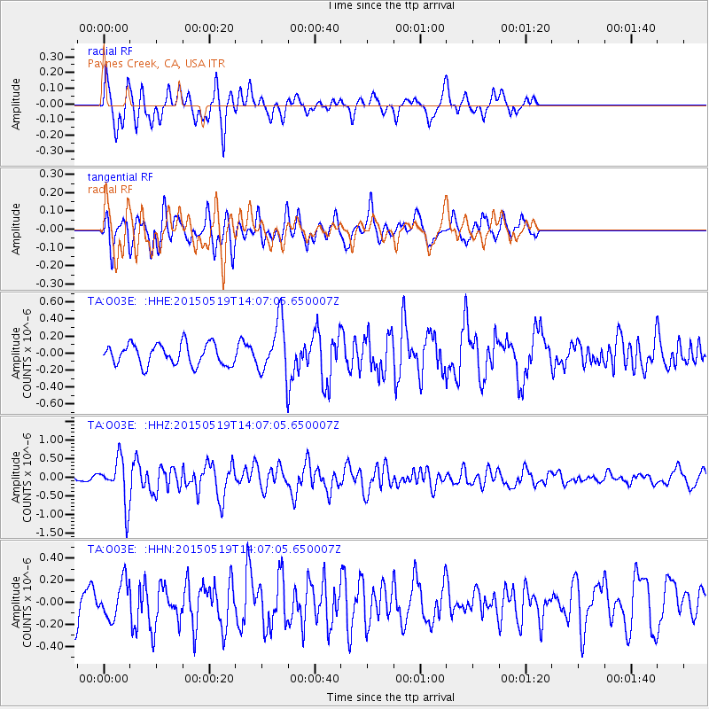
O03E Paynes Creek, CA, USA - Earthquake Result Viewer
*The percent match for this event was below the threshold and hence no stack was calculated.
| Earthquake location: |
Vanuatu Islands |
| Earthquake latitude/longitude: |
-18.6/168.6 |
| Earthquake time(UTC): |
2015/05/19 (139) 13:54:55 GMT |
| Earthquake Depth: |
50 km |
| Earthquake Magnitude: |
5.8 MWB, 5.9 MWC |
| Earthquake Catalog/Contributor: |
NEIC PDE/NEIC COMCAT |
|
| Network: |
TA USArray Transportable Network (new EarthScope stations) |
| Station: |
O03E Paynes Creek, CA, USA |
| Lat/Lon: |
40.29 N/121.80 W |
| Elevation: |
967 m |
|
| Distance: |
87.2 deg |
| Az: |
45.881 deg |
| Baz: |
242.887 deg |
| Ray Param: |
$rayparam |
*The percent match for this event was below the threshold and hence was not used in the summary stack. |
|
| Radial Match: |
58.773205 % |
| Radial Bump: |
338 |
| Transverse Match: |
64.30415 % |
| Transverse Bump: |
400 |
| SOD ConfigId: |
7422571 |
| Insert Time: |
2019-04-18 23:12:59.714 +0000 |
| GWidth: |
2.5 |
| Max Bumps: |
400 |
| Tol: |
0.001 |
|
Signal To Noise
| Channel | StoN | STA | LTA |
| TA:O03E: :HHZ:20150519T14:07:05.650007Z | 9.830957 | 6.142686E-7 | 6.248309E-8 |
| TA:O03E: :HHN:20150519T14:07:05.650007Z | 1.2731383 | 1.6453112E-7 | 1.2923272E-7 |
| TA:O03E: :HHE:20150519T14:07:05.650007Z | 2.4401402 | 3.0051473E-7 | 1.2315469E-7 |
| Arrivals |
| Ps | |
| PpPs | |
| PsPs/PpSs | |


