You are here: Home > Network List > TA - USArray Transportable Network (new EarthScope stations) Stations List
> Station R11A Troy Canyon, Currant, NV, USA > Earthquake Result Viewer
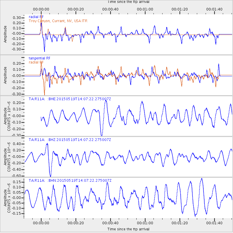
R11A Troy Canyon, Currant, NV, USA - Earthquake Result Viewer
*The percent match for this event was below the threshold and hence no stack was calculated.
| Earthquake location: |
Vanuatu Islands |
| Earthquake latitude/longitude: |
-18.6/168.6 |
| Earthquake time(UTC): |
2015/05/19 (139) 13:54:55 GMT |
| Earthquake Depth: |
50 km |
| Earthquake Magnitude: |
5.8 MWB, 5.9 MWC |
| Earthquake Catalog/Contributor: |
NEIC PDE/NEIC COMCAT |
|
| Network: |
TA USArray Transportable Network (new EarthScope stations) |
| Station: |
R11A Troy Canyon, Currant, NV, USA |
| Lat/Lon: |
38.35 N/115.59 W |
| Elevation: |
1756 m |
|
| Distance: |
90.8 deg |
| Az: |
49.685 deg |
| Baz: |
246.879 deg |
| Ray Param: |
$rayparam |
*The percent match for this event was below the threshold and hence was not used in the summary stack. |
|
| Radial Match: |
69.19802 % |
| Radial Bump: |
399 |
| Transverse Match: |
67.22518 % |
| Transverse Bump: |
400 |
| SOD ConfigId: |
7422571 |
| Insert Time: |
2019-04-18 23:13:01.996 +0000 |
| GWidth: |
2.5 |
| Max Bumps: |
400 |
| Tol: |
0.001 |
|
Signal To Noise
| Channel | StoN | STA | LTA |
| TA:R11A: :BHZ:20150519T14:07:22.275007Z | 2.471817 | 2.2607651E-7 | 9.1461665E-8 |
| TA:R11A: :BHN:20150519T14:07:22.275007Z | 0.86792314 | 6.9636215E-8 | 8.0233164E-8 |
| TA:R11A: :BHE:20150519T14:07:22.275007Z | 1.6693877 | 1.1095444E-7 | 6.646415E-8 |
| Arrivals |
| Ps | |
| PpPs | |
| PsPs/PpSs | |


