You are here: Home > Network List > UW - Pacific Northwest Regional Seismic Network Stations List
> Station MRBL Marblemount, WA, USA > Earthquake Result Viewer
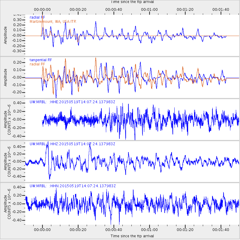
MRBL Marblemount, WA, USA - Earthquake Result Viewer
*The percent match for this event was below the threshold and hence no stack was calculated.
| Earthquake location: |
Vanuatu Islands |
| Earthquake latitude/longitude: |
-18.6/168.6 |
| Earthquake time(UTC): |
2015/05/19 (139) 13:54:55 GMT |
| Earthquake Depth: |
50 km |
| Earthquake Magnitude: |
5.8 MWB, 5.9 MWC |
| Earthquake Catalog/Contributor: |
NEIC PDE/NEIC COMCAT |
|
| Network: |
UW Pacific Northwest Regional Seismic Network |
| Station: |
MRBL Marblemount, WA, USA |
| Lat/Lon: |
48.52 N/121.48 W |
| Elevation: |
75 m |
|
| Distance: |
91.2 deg |
| Az: |
38.663 deg |
| Baz: |
243.011 deg |
| Ray Param: |
$rayparam |
*The percent match for this event was below the threshold and hence was not used in the summary stack. |
|
| Radial Match: |
69.620346 % |
| Radial Bump: |
400 |
| Transverse Match: |
68.68463 % |
| Transverse Bump: |
400 |
| SOD ConfigId: |
7422571 |
| Insert Time: |
2019-04-18 23:13:52.772 +0000 |
| GWidth: |
2.5 |
| Max Bumps: |
400 |
| Tol: |
0.001 |
|
Signal To Noise
| Channel | StoN | STA | LTA |
| UW:MRBL: :HHZ:20150519T14:07:24.137983Z | 3.7402227 | 2.7348435E-7 | 7.311981E-8 |
| UW:MRBL: :HHN:20150519T14:07:24.137983Z | 0.9134097 | 7.272586E-8 | 7.962019E-8 |
| UW:MRBL: :HHE:20150519T14:07:24.137983Z | 1.1623266 | 8.888993E-8 | 7.647586E-8 |
| Arrivals |
| Ps | |
| PpPs | |
| PsPs/PpSs | |


