You are here: Home > Network List > CI - Caltech Regional Seismic Network Stations List
> Station SLA SLA, Trona, CA, USA > Earthquake Result Viewer
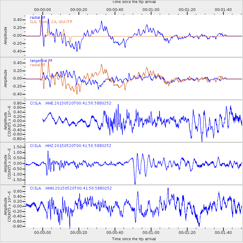
SLA SLA, Trona, CA, USA - Earthquake Result Viewer
*The percent match for this event was below the threshold and hence no stack was calculated.
| Earthquake location: |
Tonga Islands |
| Earthquake latitude/longitude: |
-19.3/-175.5 |
| Earthquake time(UTC): |
2015/05/20 (140) 00:30:51 GMT |
| Earthquake Depth: |
180 km |
| Earthquake Magnitude: |
6.0 MWP |
| Earthquake Catalog/Contributor: |
NEIC PDE/NEIC COMCAT |
|
| Network: |
CI Caltech Regional Seismic Network |
| Station: |
SLA SLA, Trona, CA, USA |
| Lat/Lon: |
35.89 N/117.28 W |
| Elevation: |
1174 m |
|
| Distance: |
77.7 deg |
| Az: |
44.917 deg |
| Baz: |
235.213 deg |
| Ray Param: |
$rayparam |
*The percent match for this event was below the threshold and hence was not used in the summary stack. |
|
| Radial Match: |
67.253334 % |
| Radial Bump: |
400 |
| Transverse Match: |
58.312443 % |
| Transverse Bump: |
400 |
| SOD ConfigId: |
7422571 |
| Insert Time: |
2019-04-18 23:24:03.313 +0000 |
| GWidth: |
2.5 |
| Max Bumps: |
400 |
| Tol: |
0.001 |
|
Signal To Noise
| Channel | StoN | STA | LTA |
| CI:SLA: :HHZ:20150520T00:41:56.588025Z | 4.1057916 | 4.368859E-7 | 1.0640722E-7 |
| CI:SLA: :HHN:20150520T00:41:56.588025Z | 1.9758298 | 2.2473967E-7 | 1.1374444E-7 |
| CI:SLA: :HHE:20150520T00:41:56.588025Z | 1.783547 | 2.6429484E-7 | 1.4818497E-7 |
| Arrivals |
| Ps | |
| PpPs | |
| PsPs/PpSs | |


