You are here: Home > Network List > TA - USArray Transportable Network (new EarthScope stations) Stations List
> Station MDND Maddock, ND, USA > Earthquake Result Viewer
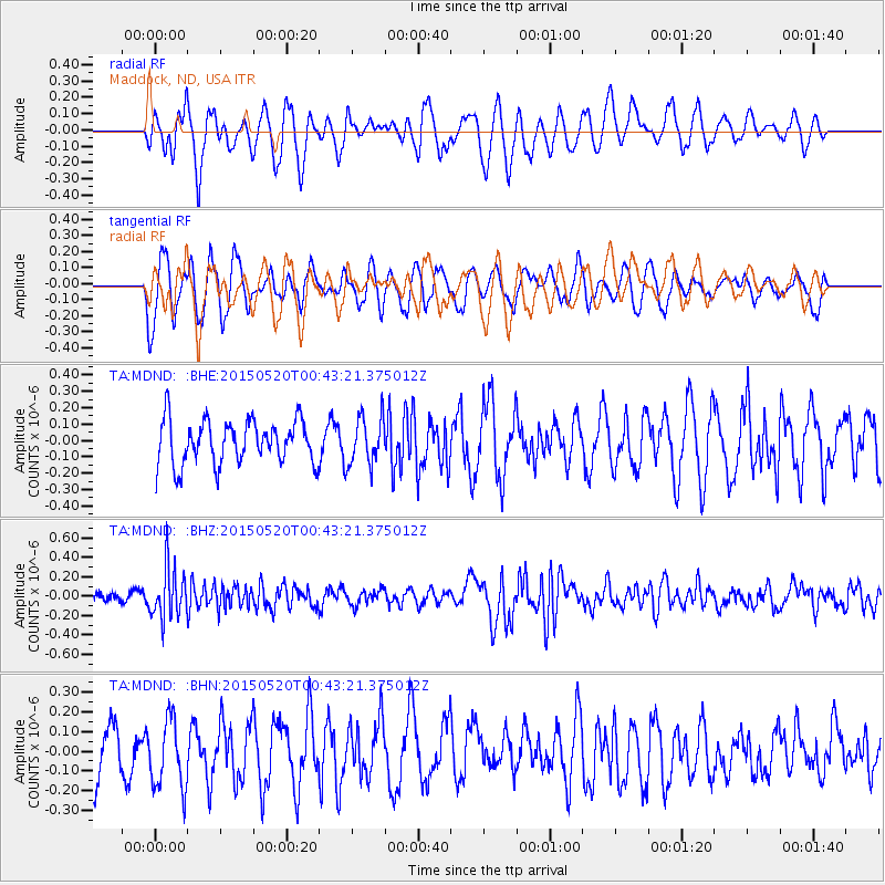
MDND Maddock, ND, USA - Earthquake Result Viewer
*The percent match for this event was below the threshold and hence no stack was calculated.
| Earthquake location: |
Tonga Islands |
| Earthquake latitude/longitude: |
-19.3/-175.5 |
| Earthquake time(UTC): |
2015/05/20 (140) 00:30:51 GMT |
| Earthquake Depth: |
180 km |
| Earthquake Magnitude: |
6.0 MWP |
| Earthquake Catalog/Contributor: |
NEIC PDE/NEIC COMCAT |
|
| Network: |
TA USArray Transportable Network (new EarthScope stations) |
| Station: |
MDND Maddock, ND, USA |
| Lat/Lon: |
47.85 N/99.60 W |
| Elevation: |
479 m |
|
| Distance: |
95.0 deg |
| Az: |
40.97 deg |
| Baz: |
246.834 deg |
| Ray Param: |
$rayparam |
*The percent match for this event was below the threshold and hence was not used in the summary stack. |
|
| Radial Match: |
45.07199 % |
| Radial Bump: |
331 |
| Transverse Match: |
40.831615 % |
| Transverse Bump: |
400 |
| SOD ConfigId: |
7422571 |
| Insert Time: |
2019-04-18 23:27:22.500 +0000 |
| GWidth: |
2.5 |
| Max Bumps: |
400 |
| Tol: |
0.001 |
|
Signal To Noise
| Channel | StoN | STA | LTA |
| TA:MDND: :BHZ:20150520T00:43:21.375012Z | 4.691446 | 2.6816954E-7 | 5.7161387E-8 |
| TA:MDND: :BHN:20150520T00:43:21.375012Z | 1.245646 | 1.7679444E-7 | 1.4192993E-7 |
| TA:MDND: :BHE:20150520T00:43:21.375012Z | 1.10554 | 1.446977E-7 | 1.3088416E-7 |
| Arrivals |
| Ps | |
| PpPs | |
| PsPs/PpSs | |


