You are here: Home > Network List > TA - USArray Transportable Network (new EarthScope stations) Stations List
> Station R11A Troy Canyon, Currant, NV, USA > Earthquake Result Viewer
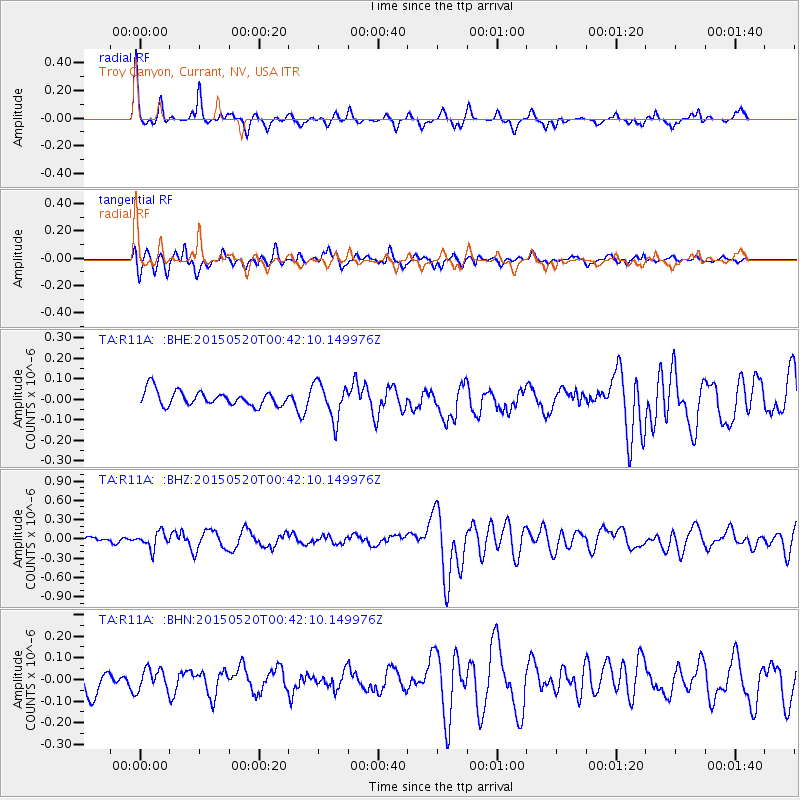
R11A Troy Canyon, Currant, NV, USA - Earthquake Result Viewer
*The percent match for this event was below the threshold and hence no stack was calculated.
| Earthquake location: |
Tonga Islands |
| Earthquake latitude/longitude: |
-19.3/-175.5 |
| Earthquake time(UTC): |
2015/05/20 (140) 00:30:51 GMT |
| Earthquake Depth: |
180 km |
| Earthquake Magnitude: |
6.0 MWP |
| Earthquake Catalog/Contributor: |
NEIC PDE/NEIC COMCAT |
|
| Network: |
TA USArray Transportable Network (new EarthScope stations) |
| Station: |
R11A Troy Canyon, Currant, NV, USA |
| Lat/Lon: |
38.35 N/115.59 W |
| Elevation: |
1756 m |
|
| Distance: |
80.2 deg |
| Az: |
43.636 deg |
| Baz: |
235.989 deg |
| Ray Param: |
$rayparam |
*The percent match for this event was below the threshold and hence was not used in the summary stack. |
|
| Radial Match: |
73.518555 % |
| Radial Bump: |
273 |
| Transverse Match: |
56.74547 % |
| Transverse Bump: |
400 |
| SOD ConfigId: |
7422571 |
| Insert Time: |
2019-04-18 23:27:27.634 +0000 |
| GWidth: |
2.5 |
| Max Bumps: |
400 |
| Tol: |
0.001 |
|
Signal To Noise
| Channel | StoN | STA | LTA |
| TA:R11A: :BHZ:20150520T00:42:10.149976Z | 2.3760421 | 1.2538554E-7 | 5.2770755E-8 |
| TA:R11A: :BHN:20150520T00:42:10.149976Z | 0.8504054 | 5.0142024E-8 | 5.89625E-8 |
| TA:R11A: :BHE:20150520T00:42:10.149976Z | 2.2951107 | 8.306127E-8 | 3.6190528E-8 |
| Arrivals |
| Ps | |
| PpPs | |
| PsPs/PpSs | |


