
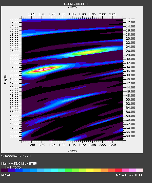
PMG Port Moresby, New Guinea - Earthquake Result Viewer
| ||||||||||||||||||
| ||||||||||||||||||
| ||||||||||||||||||
|
Signal To Noise
| Channel | StoN | STA | LTA |
| IU:PMG:00:BHN:20021102T01:34:48.819019Z | 0.999599 | 1.403517E-7 | 1.4040802E-7 |
| IU:PMG:00:BHE:20021102T01:34:48.819019Z | 1.488869 | 1.9707576E-7 | 1.323661E-7 |
| IU:PMG:00:BHZ:20021102T01:34:48.819019Z | 3.0543919 | 4.6660554E-7 | 1.5276545E-7 |
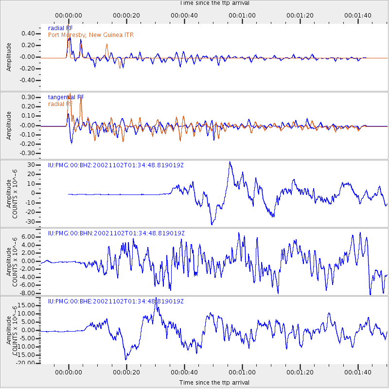
| Arrivals | |
| Ps | 4.3 SECOND |
| PpPs | 15 SECOND |
| PsPs/PpSs | 19 SECOND |

