You are here: Home > Network List > TA - USArray Transportable Network (new EarthScope stations) Stations List
> Station A21K Barrow, AK, USA > Earthquake Result Viewer
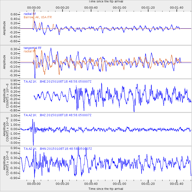
A21K Barrow, AK, USA - Earthquake Result Viewer
*The percent match for this event was below the threshold and hence no stack was calculated.
| Earthquake location: |
Hokkaido, Japan Region |
| Earthquake latitude/longitude: |
43.7/144.9 |
| Earthquake time(UTC): |
2015/01/08 (008) 18:42:11 GMT |
| Earthquake Depth: |
131 km |
| Earthquake Magnitude: |
5.5 MB |
| Earthquake Catalog/Contributor: |
NEIC PDE/NEIC COMCAT |
|
| Network: |
TA USArray Transportable Network (new EarthScope stations) |
| Station: |
A21K Barrow, AK, USA |
| Lat/Lon: |
71.32 N/156.62 W |
| Elevation: |
577 m |
|
| Distance: |
39.3 deg |
| Az: |
25.681 deg |
| Baz: |
257.491 deg |
| Ray Param: |
$rayparam |
*The percent match for this event was below the threshold and hence was not used in the summary stack. |
|
| Radial Match: |
72.240906 % |
| Radial Bump: |
400 |
| Transverse Match: |
68.7451 % |
| Transverse Bump: |
400 |
| SOD ConfigId: |
828811 |
| Insert Time: |
2015-01-22 19:21:22.928 +0000 |
| GWidth: |
2.5 |
| Max Bumps: |
400 |
| Tol: |
0.001 |
|
Signal To Noise
| Channel | StoN | STA | LTA |
| TA:A21K: :BHZ:20150108T18:48:58.050007Z | 9.072607 | 1.0597956E-6 | 1.16812686E-7 |
| TA:A21K: :BHN:20150108T18:48:58.050007Z | 1.7569818 | 3.5825158E-7 | 2.039017E-7 |
| TA:A21K: :BHE:20150108T18:48:58.050007Z | 2.3928783 | 3.431512E-7 | 1.434052E-7 |
| Arrivals |
| Ps | |
| PpPs | |
| PsPs/PpSs | |


