PMG Port Moresby, New Guinea - Earthquake Result Viewer
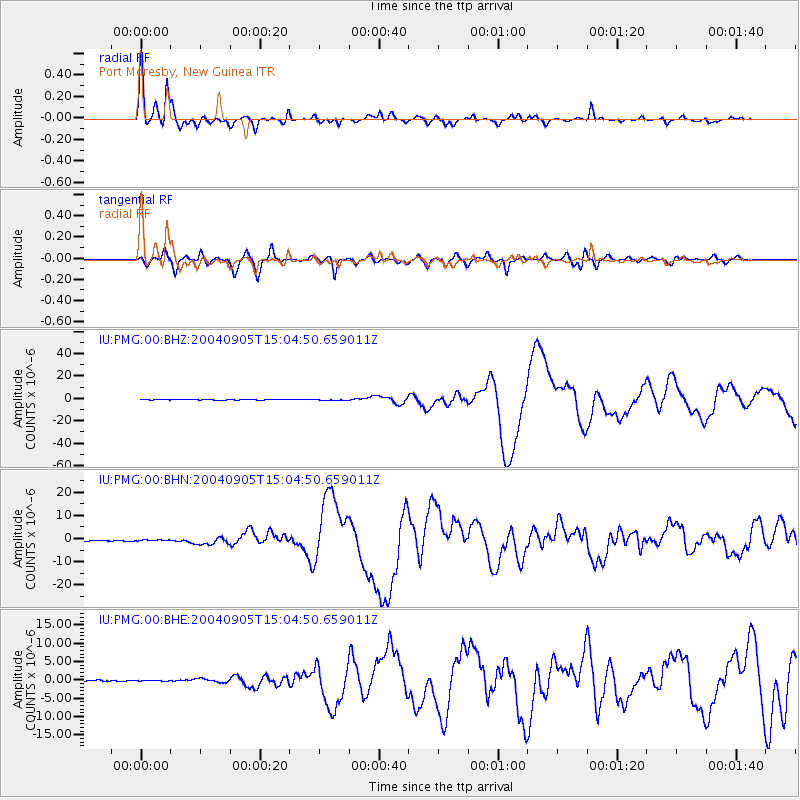
Earthquake location: Near S. Coast Of Honshu, Japan
Earthquake latitude/longitude: 33.2/137.1
Earthquake time(UTC): 2004/09/05 (249) 14:57:18 GMT
Earthquake Depth: 10 km
Earthquake Magnitude: 6.2 MB, 7.1 MS, 7.4 MW, 7.4 MW
Earthquake Catalog/Contributor: WHDF/NEIC
Network: IU Global Seismograph Network (GSN - IRIS/USGS)
Station: PMG Port Moresby, New Guinea
Lat/Lon: 9.41 S/147.15 E
Elevation: 67 m
Distance: 43.4 deg
Az: 165.447 deg
Baz: 347.669 deg
Ray Param: 0.072556965
Estimated Moho Depth: 23.0 km
Estimated Crust Vp/Vs: 2.10
Assumed Crust Vp: 6.122 km/s
Estimated Crust Vs: 2.919 km/s
Estimated Crust Poisson's Ratio: 0.35
Radial Match: 93.37435 %
Radial Bump: 400
Transverse Match: 86.26949 %
Transverse Bump: 400
SOD ConfigId: 2459
Insert Time: 2010-03-02 15:08:46.296 +0000
GWidth: 2.5
Max Bumps: 400
Tol: 0.001

Signal To Noise

ChannelStoNSTALTA
IU:PMG:00:BHN:20040905T15:04:50.659011Z1.5063952.3163328E-71.5376663E-7
IU:PMG:00:BHE:20040905T15:04:50.659011Z0.942583741.362698E-71.4457049E-7
IU:PMG:00:BHZ:20040905T15:04:50.659011Z2.54728984.4214102E-71.7357311E-7
Arrivals
Ps4.3 SECOND
PpPs11 SECOND
PsPs/PpSs15 SECOND