PMG Port Moresby, New Guinea - Earthquake Result Viewer
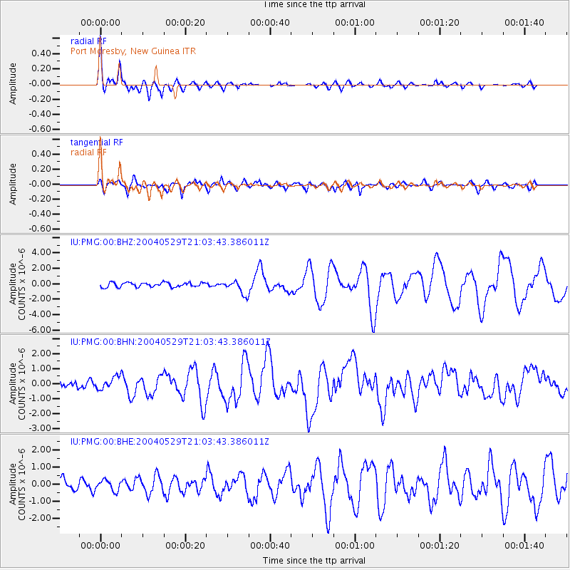
Earthquake location: Off East Coast Of Honshu, Japan
Earthquake latitude/longitude: 34.3/141.4
Earthquake time(UTC): 2004/05/29 (150) 20:56:09 GMT
Earthquake Depth: 16 km
Earthquake Magnitude: 5.6 MB, 6.6 MS, 6.5 MW, 6.3 MW
Earthquake Catalog/Contributor: WHDF/NEIC
Network: IU Global Seismograph Network (GSN - IRIS/USGS)
Station: PMG Port Moresby, New Guinea
Lat/Lon: 9.41 S/147.15 E
Elevation: 67 m
Distance: 43.8 deg
Az: 171.786 deg
Baz: 353.111 deg
Ray Param: 0.07232603
Estimated Moho Depth: 10.0 km
Estimated Crust Vp/Vs: 2.05
Assumed Crust Vp: 6.122 km/s
Estimated Crust Vs: 2.99 km/s
Estimated Crust Poisson's Ratio: 0.34
Radial Match: 92.359024 %
Radial Bump: 400
Transverse Match: 83.52236 %
Transverse Bump: 400
SOD ConfigId: 2459
Insert Time: 2010-03-02 15:08:54.376 +0000
GWidth: 2.5
Max Bumps: 400
Tol: 0.001

Signal To Noise

ChannelStoNSTALTA
IU:PMG:00:BHN:20040529T21:03:43.386011Z1.93578434.4321308E-72.2895789E-7
IU:PMG:00:BHE:20040529T21:03:43.386011Z0.68195513.0863805E-74.5257826E-7
IU:PMG:00:BHZ:20040529T21:03:43.386011Z3.16182289.156841E-72.896064E-7
Arrivals
Ps1.8 SECOND
PpPs4.7 SECOND
PsPs/PpSs6.5 SECOND