PMG Port Moresby, New Guinea - Earthquake Result Viewer
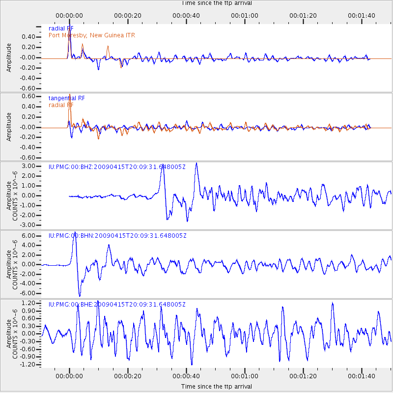
Earthquake location: Southern Sumatra, Indonesia
Earthquake latitude/longitude: -3.1/100.5
Earthquake time(UTC): 2009/04/15 (105) 20:01:34 GMT
Earthquake Depth: 20 km
Earthquake Magnitude: 6.1 MB, 6.4 MS, 6.4 MW, 6.2 MW
Earthquake Catalog/Contributor: WHDF/NEIC
Network: IU Global Seismograph Network (GSN - IRIS/USGS)
Station: PMG Port Moresby, New Guinea
Lat/Lon: 9.41 S/147.15 E
Elevation: 67 m
Distance: 46.8 deg
Az: 99.925 deg
Baz: 274.561 deg
Ray Param: 0.070395164
Estimated Moho Depth: 31.5 km
Estimated Crust Vp/Vs: 1.82
Assumed Crust Vp: 6.122 km/s
Estimated Crust Vs: 3.373 km/s
Estimated Crust Poisson's Ratio: 0.28
Radial Match: 92.70844 %
Radial Bump: 400
Transverse Match: 84.83862 %
Transverse Bump: 400
SOD ConfigId: 2760
Insert Time: 2010-03-02 15:09:01.359 +0000
GWidth: 2.5
Max Bumps: 400
Tol: 0.001

Signal To Noise

ChannelStoNSTALTA
IU:PMG:00:BHN:20090415T20:09:31.648005Z33.383163.9327774E-61.1780724E-7
IU:PMG:00:BHE:20090415T20:09:31.648005Z4.38510235.378509E-71.2265411E-7
IU:PMG:00:BHZ:20090415T20:09:31.648005Z16.484091.7425812E-61.0571291E-7
Arrivals
Ps4.4 SECOND
PpPs14 SECOND
PsPs/PpSs18 SECOND