You are here: Home > Network List > IU - Global Seismograph Network (GSN - IRIS/USGS) Stations List
> Station RSSD Black Hills, South Dakota, USA > Earthquake Result Viewer
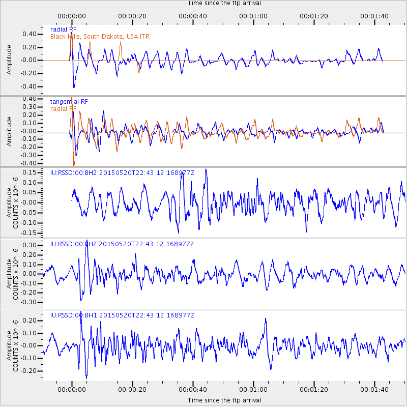
RSSD Black Hills, South Dakota, USA - Earthquake Result Viewer
*The percent match for this event was below the threshold and hence no stack was calculated.
| Earthquake location: |
Peru-Ecuador Border Region |
| Earthquake latitude/longitude: |
-3.1/-77.7 |
| Earthquake time(UTC): |
2015/05/20 (140) 22:34:30 GMT |
| Earthquake Depth: |
20 km |
| Earthquake Magnitude: |
5.1 mb, 5.1 mb |
| Earthquake Catalog/Contributor: |
ISC/ISC |
|
| Network: |
IU Global Seismograph Network (GSN - IRIS/USGS) |
| Station: |
RSSD Black Hills, South Dakota, USA |
| Lat/Lon: |
44.12 N/104.04 W |
| Elevation: |
2090 m |
|
| Distance: |
52.6 deg |
| Az: |
336.286 deg |
| Baz: |
146.11 deg |
| Ray Param: |
$rayparam |
*The percent match for this event was below the threshold and hence was not used in the summary stack. |
|
| Radial Match: |
69.04812 % |
| Radial Bump: |
400 |
| Transverse Match: |
51.9218 % |
| Transverse Bump: |
400 |
| SOD ConfigId: |
7422571 |
| Insert Time: |
2019-04-18 23:42:58.790 +0000 |
| GWidth: |
2.5 |
| Max Bumps: |
400 |
| Tol: |
0.001 |
|
Signal To Noise
| Channel | StoN | STA | LTA |
| IU:RSSD:00:BHZ:20150520T22:43:12.168977Z | 4.0315027 | 1.4654385E-7 | 3.634969E-8 |
| IU:RSSD:00:BH1:20150520T22:43:12.168977Z | 1.9513806 | 1.0550621E-7 | 5.406747E-8 |
| IU:RSSD:00:BH2:20150520T22:43:12.168977Z | 1.0101745 | 4.4264404E-8 | 4.381857E-8 |
| Arrivals |
| Ps | |
| PpPs | |
| PsPs/PpSs | |


