
PMG Port Moresby, New Guinea - Earthquake Result Viewer
| ||||||||||||||||||
| ||||||||||||||||||
| ||||||||||||||||||
|
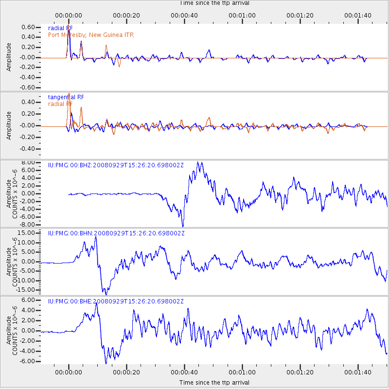
Signal To Noise
| Channel | StoN | STA | LTA |
| IU:PMG:00:BHN:20080929T15:26:20.698002Z | 20.300556 | 2.9235036E-6 | 1.4401101E-7 |
| IU:PMG:00:BHE:20080929T15:26:20.698002Z | 9.087804 | 8.773893E-7 | 9.6545804E-8 |
| IU:PMG:00:BHZ:20080929T15:26:20.698002Z | 9.364621 | 1.2977803E-6 | 1.3858332E-7 |
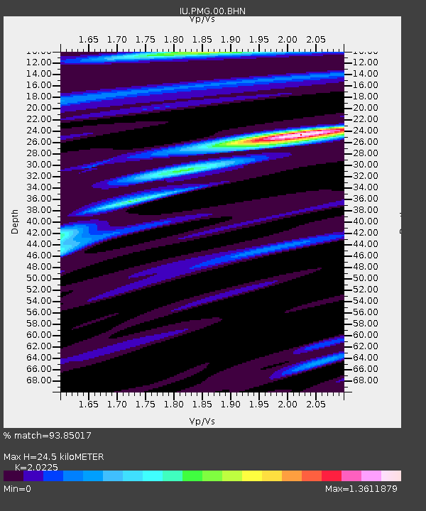
| Arrivals | |
| Ps | 4.3 SECOND |
| PpPs | 11 SECOND |
| PsPs/PpSs | 16 SECOND |

