PMG Port Moresby, New Guinea - Earthquake Result Viewer
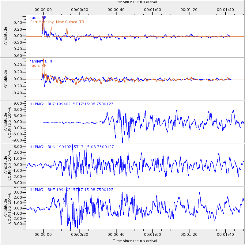
Earthquake location: Southern Sumatra, Indonesia
Earthquake latitude/longitude: -5.0/104.2
Earthquake time(UTC): 1994/02/15 (046) 17:07:42 GMT
Earthquake Depth: 15 km
Earthquake Magnitude: 6.0 MB, 7.0 MS, 6.8 UNKNOWN, 6.9 MW
Earthquake Catalog/Contributor: WHDF/NEIC
Network: IU Global Seismograph Network (GSN - IRIS/USGS)
Station: PMG Port Moresby, New Guinea
Lat/Lon: 9.41 S/147.15 E
Elevation: 67 m
Distance: 42.8 deg
Az: 98.35 deg
Baz: 272.72 deg
Ray Param: 0.072961465
Estimated Moho Depth: 33.0 km
Estimated Crust Vp/Vs: 1.74
Assumed Crust Vp: 6.122 km/s
Estimated Crust Vs: 3.513 km/s
Estimated Crust Poisson's Ratio: 0.25
Radial Match: 94.20198 %
Radial Bump: 399
Transverse Match: 90.32684 %
Transverse Bump: 400
SOD ConfigId: 16938
Insert Time: 2010-03-02 15:10:39.233 +0000
GWidth: 2.5
Max Bumps: 400
Tol: 0.001

Signal To Noise

ChannelStoNSTALTA
IU:PMG: :BHN:19940215T17:15:08.750012Z1.42127192.2647733E-71.5934833E-7
IU:PMG: :BHE:19940215T17:15:08.750012Z2.626483.4616895E-71.3179958E-7
IU:PMG: :BHZ:19940215T17:15:08.750012Z5.4092899.984255E-71.8457612E-7
Arrivals
Ps4.3 SECOND
PpPs14 SECOND
PsPs/PpSs18 SECOND