You are here: Home > Network List > TA - USArray Transportable Network (new EarthScope stations) Stations List
> Station G59A Clarenceville, QC, USA > Earthquake Result Viewer
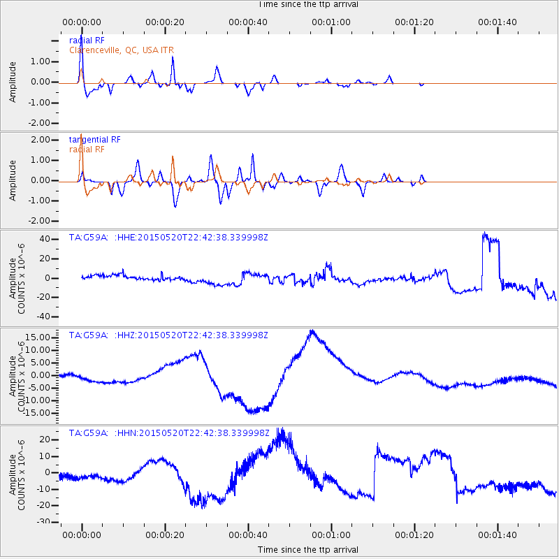
G59A Clarenceville, QC, USA - Earthquake Result Viewer
*The percent match for this event was below the threshold and hence no stack was calculated.
| Earthquake location: |
Peru-Ecuador Border Region |
| Earthquake latitude/longitude: |
-3.1/-77.7 |
| Earthquake time(UTC): |
2015/05/20 (140) 22:34:30 GMT |
| Earthquake Depth: |
20 km |
| Earthquake Magnitude: |
5.1 mb, 5.1 mb |
| Earthquake Catalog/Contributor: |
ISC/ISC |
|
| Network: |
TA USArray Transportable Network (new EarthScope stations) |
| Station: |
G59A Clarenceville, QC, USA |
| Lat/Lon: |
45.08 N/73.18 W |
| Elevation: |
36 m |
|
| Distance: |
48.1 deg |
| Az: |
4.29 deg |
| Baz: |
186.052 deg |
| Ray Param: |
$rayparam |
*The percent match for this event was below the threshold and hence was not used in the summary stack. |
|
| Radial Match: |
76.1427 % |
| Radial Bump: |
400 |
| Transverse Match: |
67.41969 % |
| Transverse Bump: |
400 |
| SOD ConfigId: |
7422571 |
| Insert Time: |
2019-04-18 23:45:41.455 +0000 |
| GWidth: |
2.5 |
| Max Bumps: |
400 |
| Tol: |
0.001 |
|
Signal To Noise
| Channel | StoN | STA | LTA |
| TA:G59A: :HHZ:20150520T22:42:38.339998Z | 0.3889664 | 8.3856065E-7 | 2.155869E-6 |
| TA:G59A: :HHN:20150520T22:42:38.339998Z | 0.28243583 | 1.0106068E-6 | 3.578182E-6 |
| TA:G59A: :HHE:20150520T22:42:38.339998Z | 3.1516345 | 7.07204E-6 | 2.2439278E-6 |
| Arrivals |
| Ps | |
| PpPs | |
| PsPs/PpSs | |


